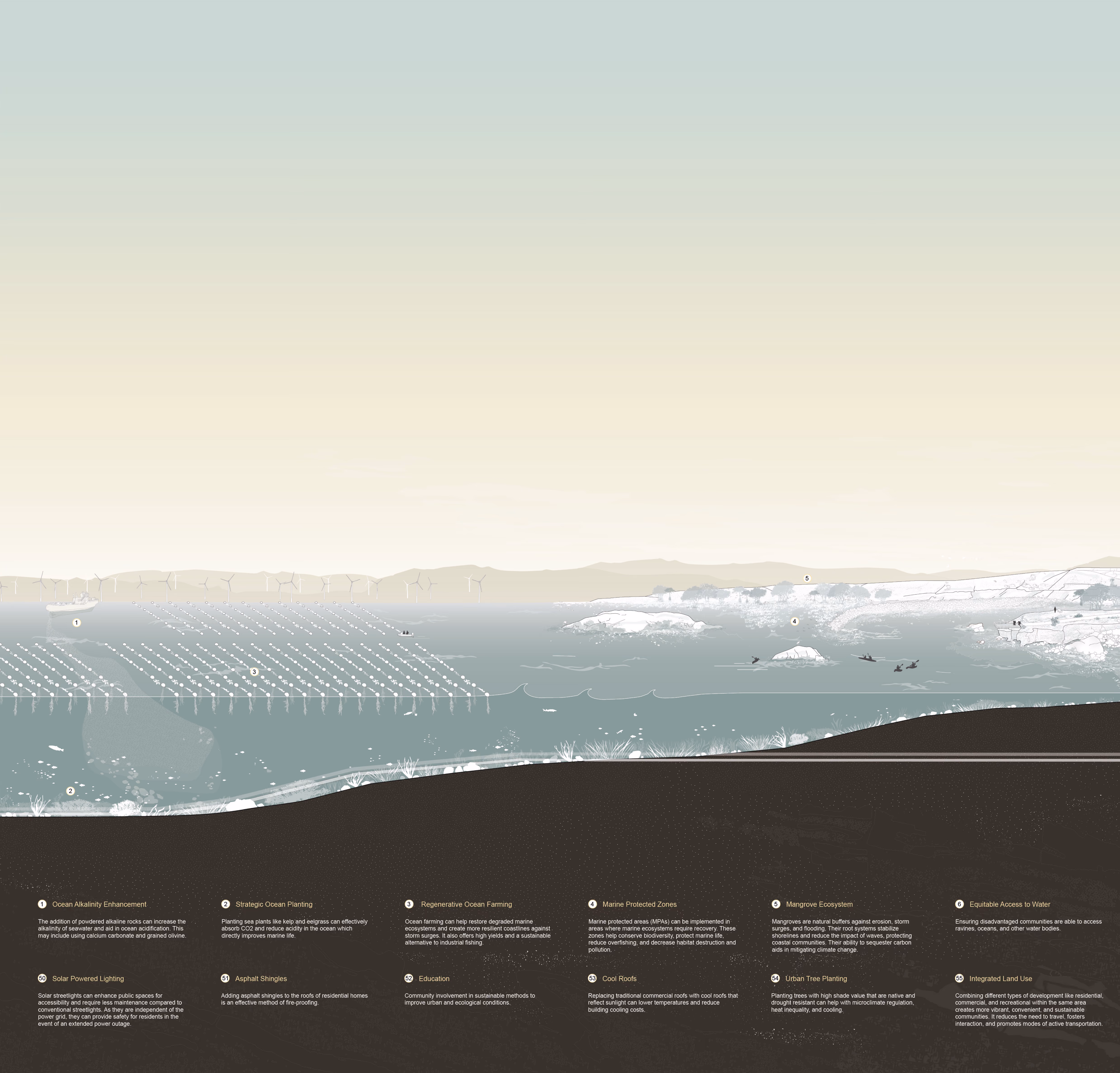
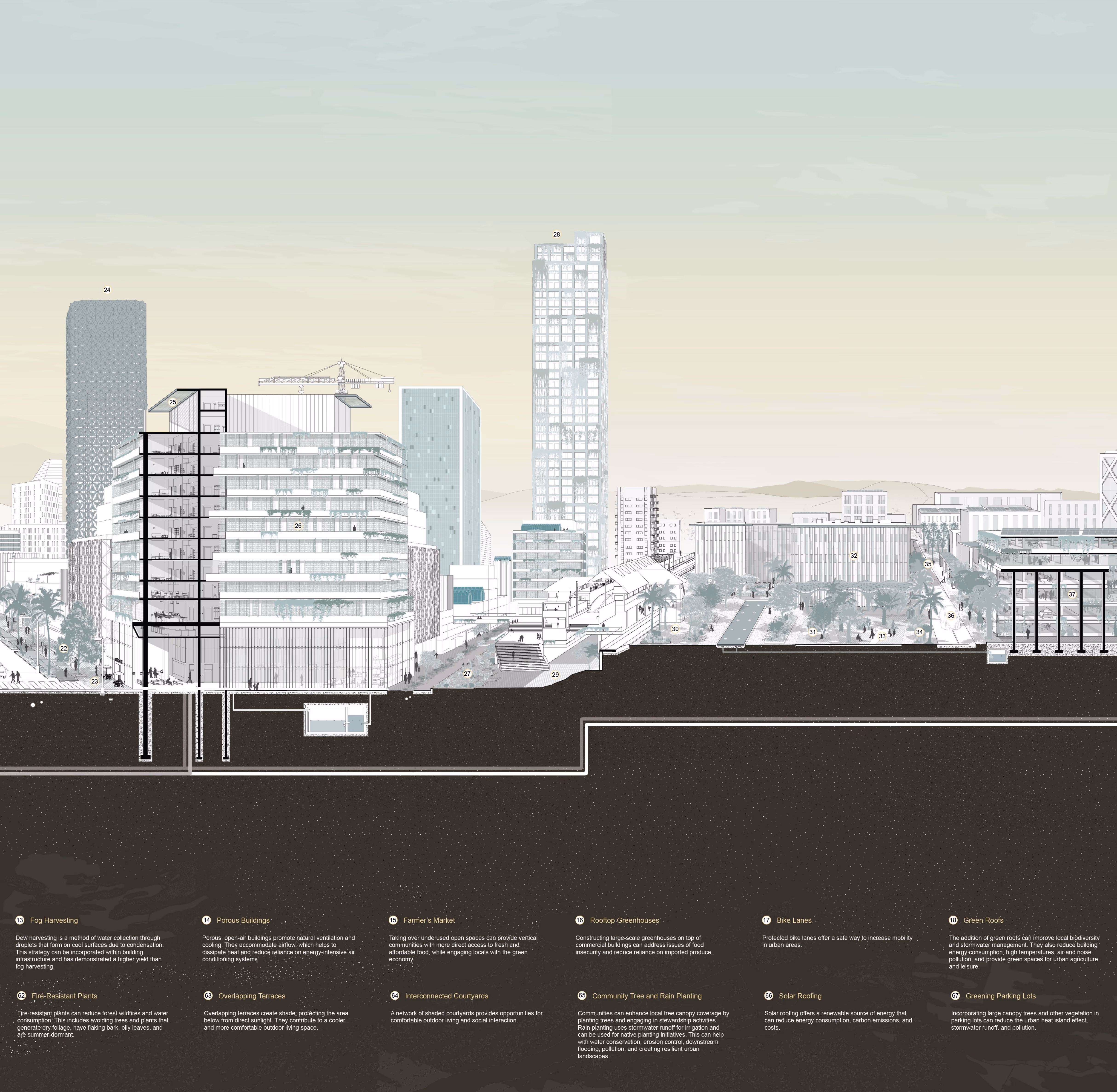
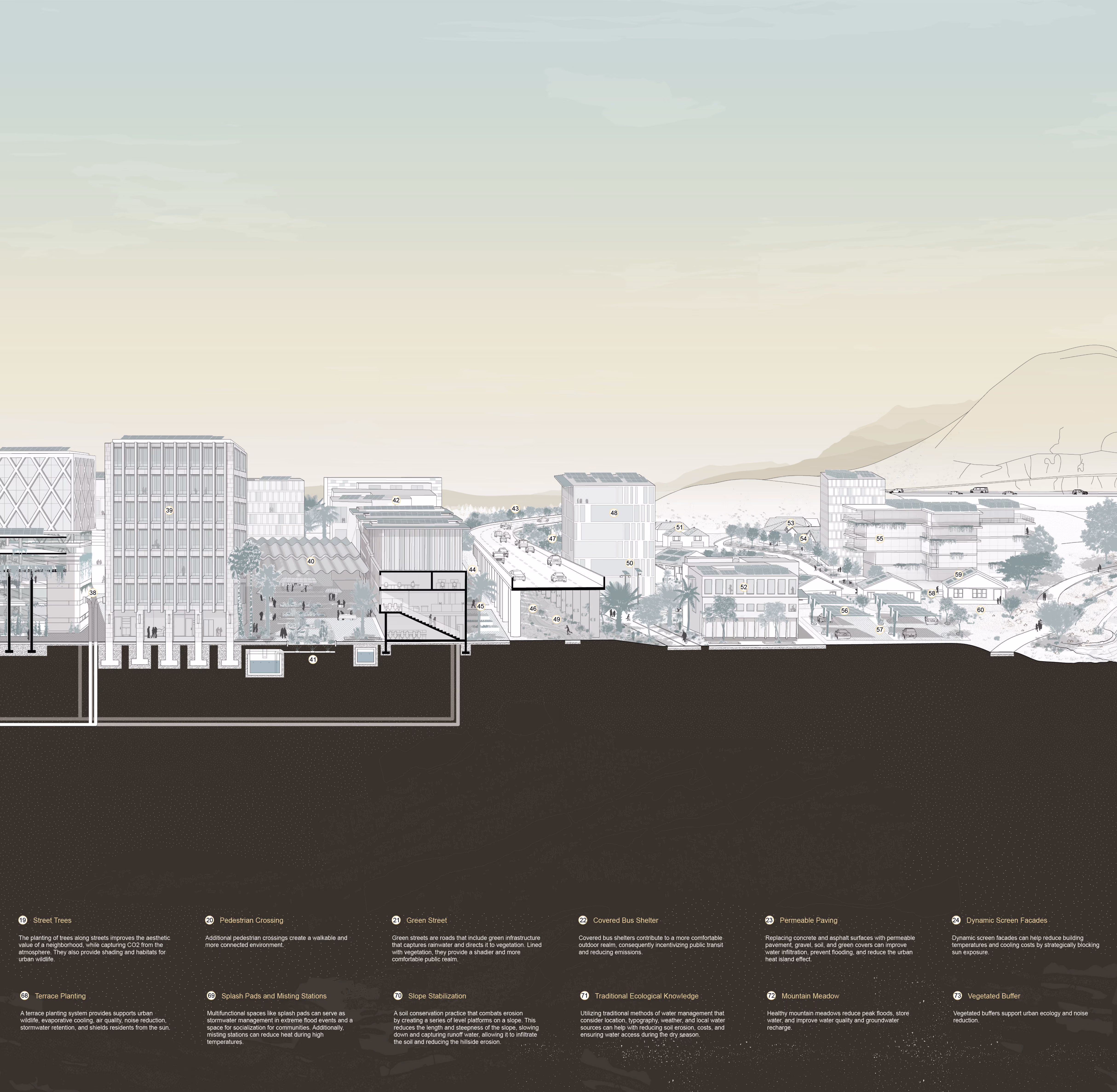
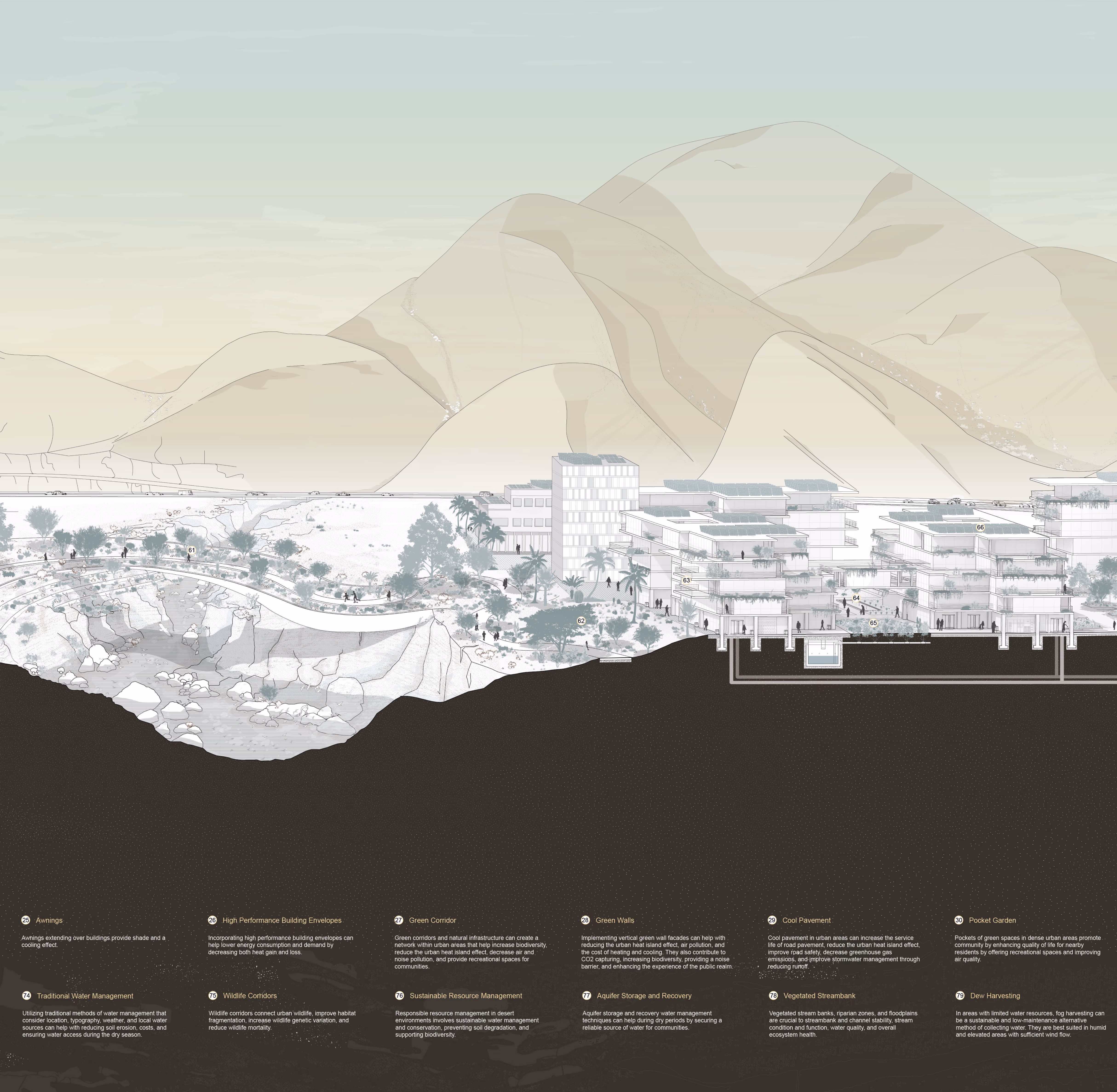
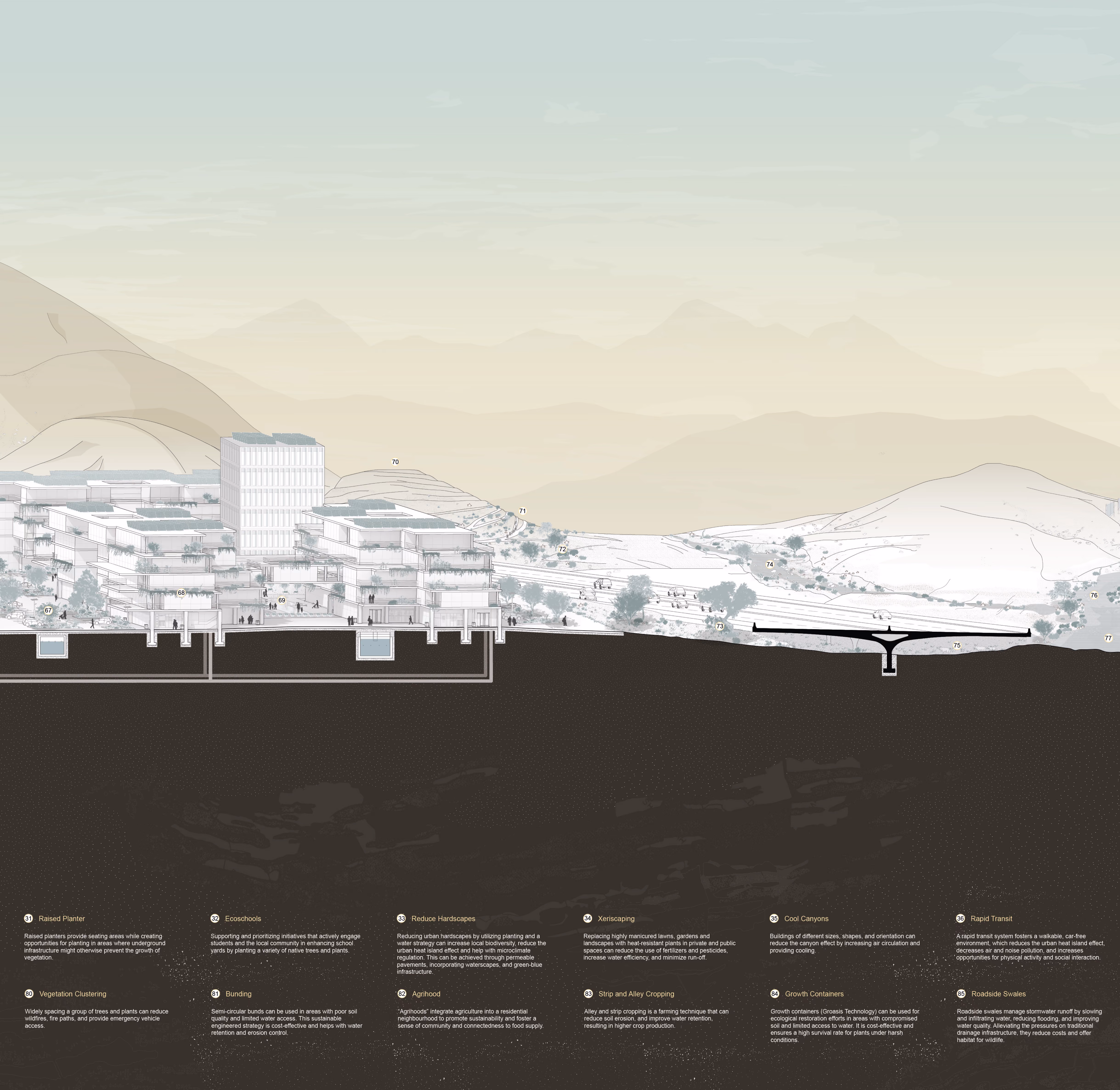
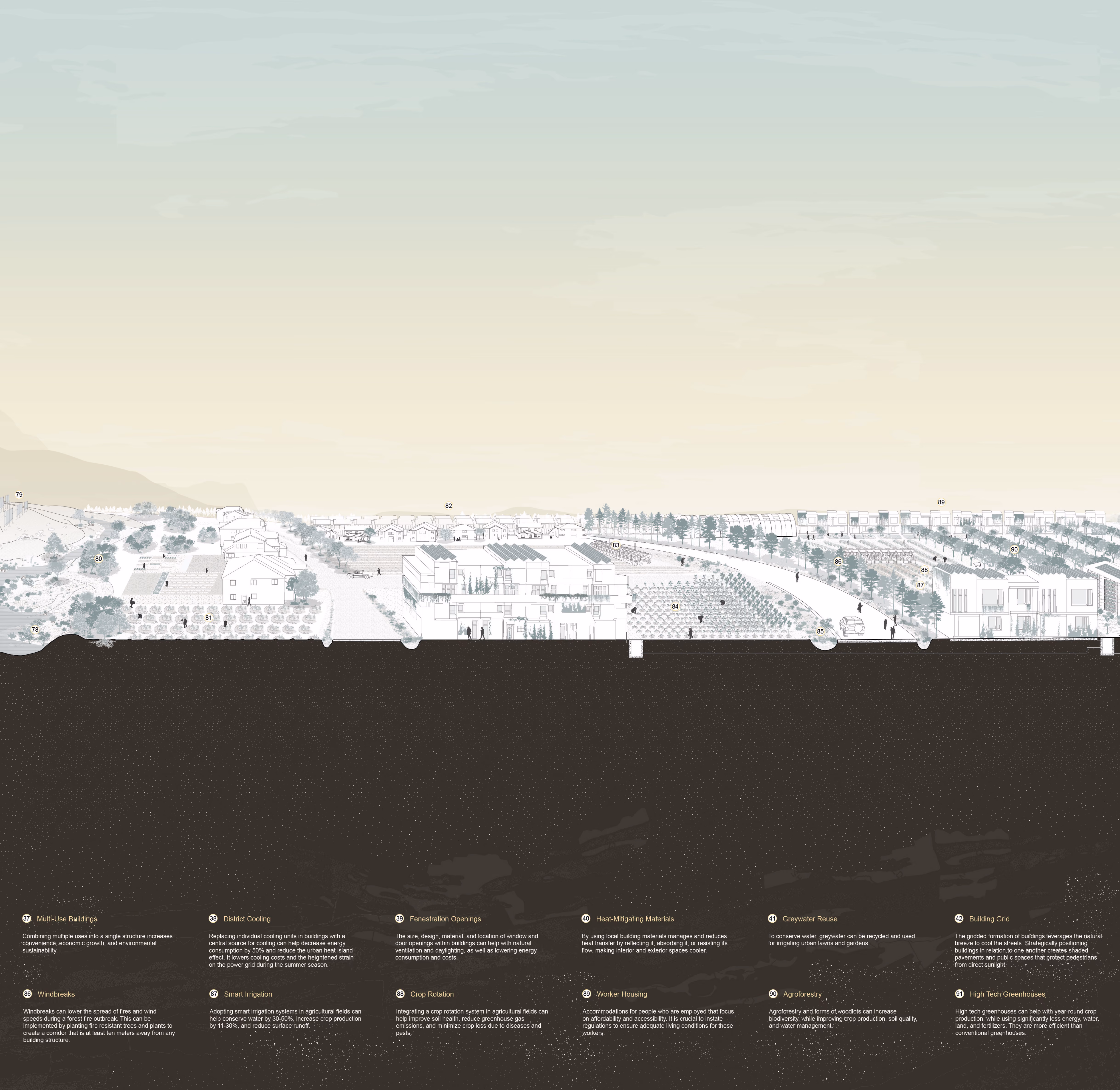
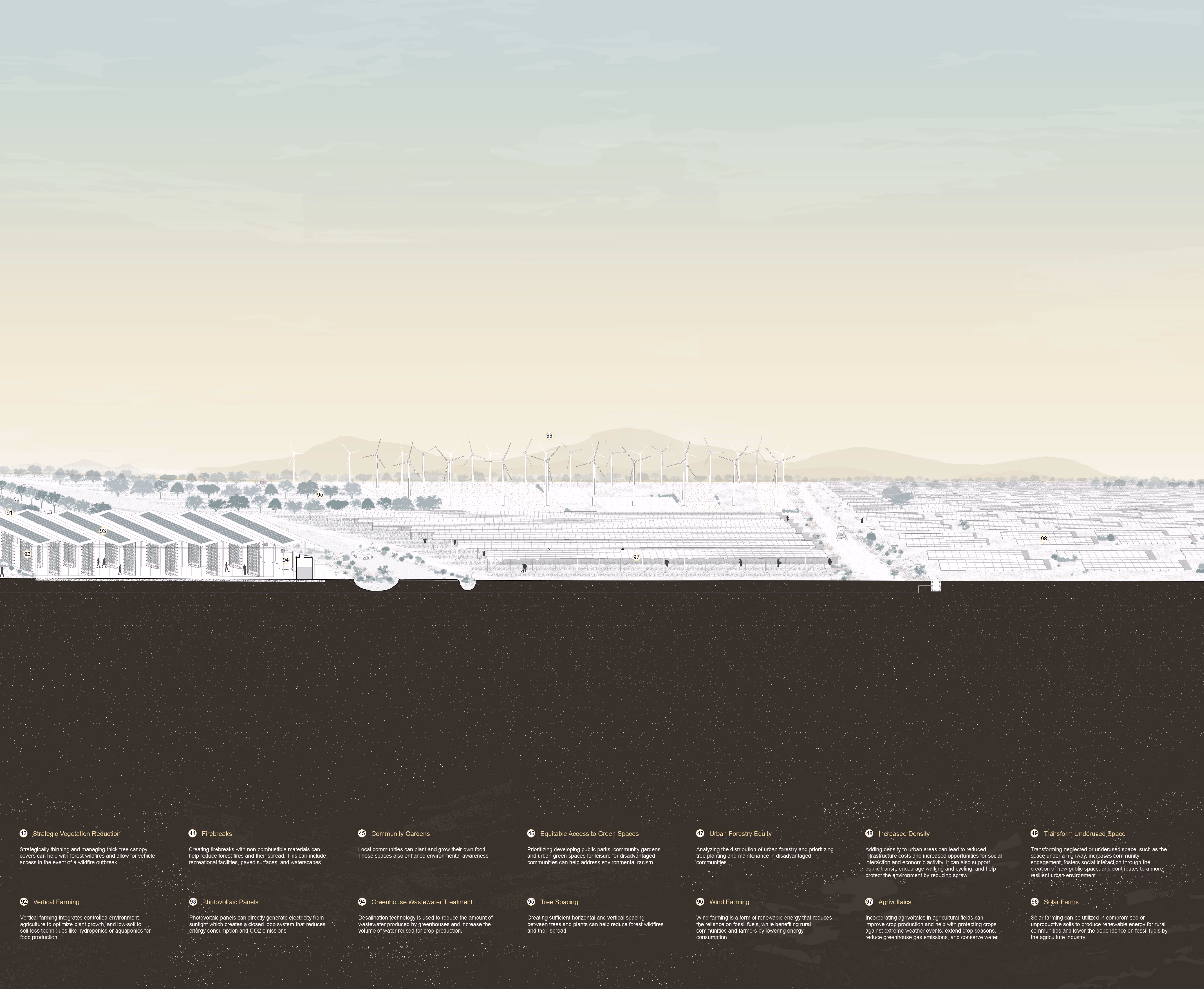
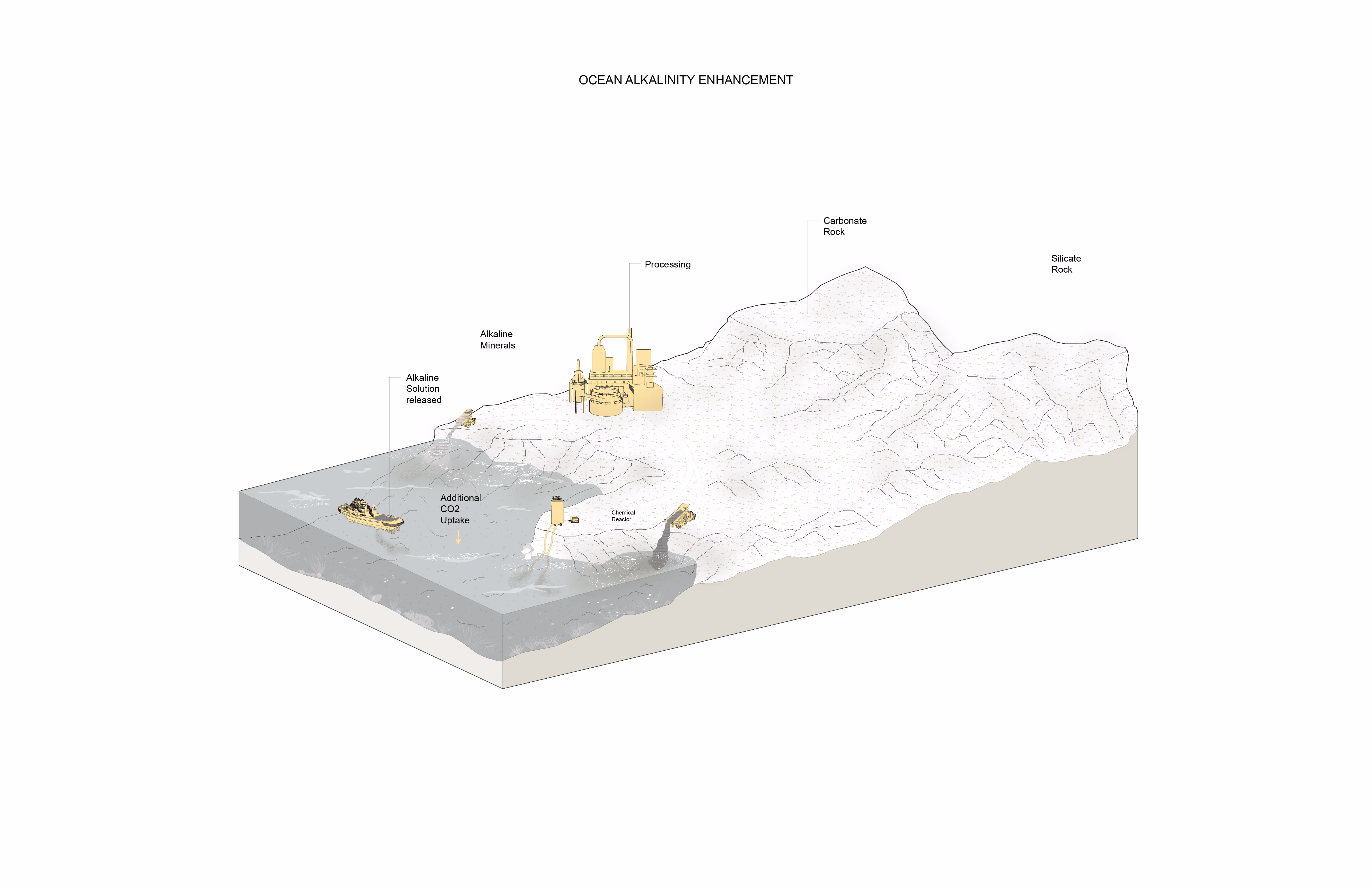
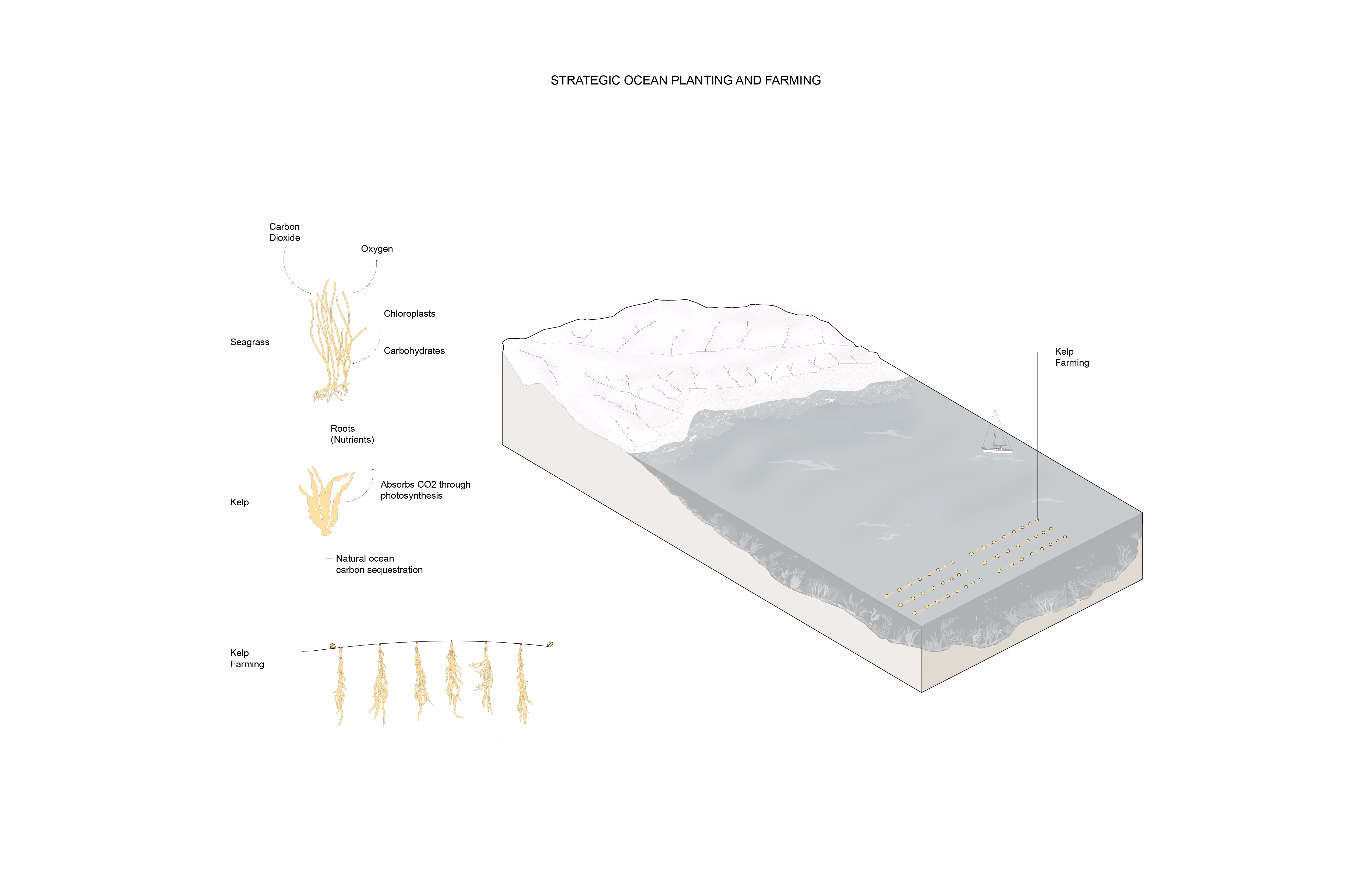
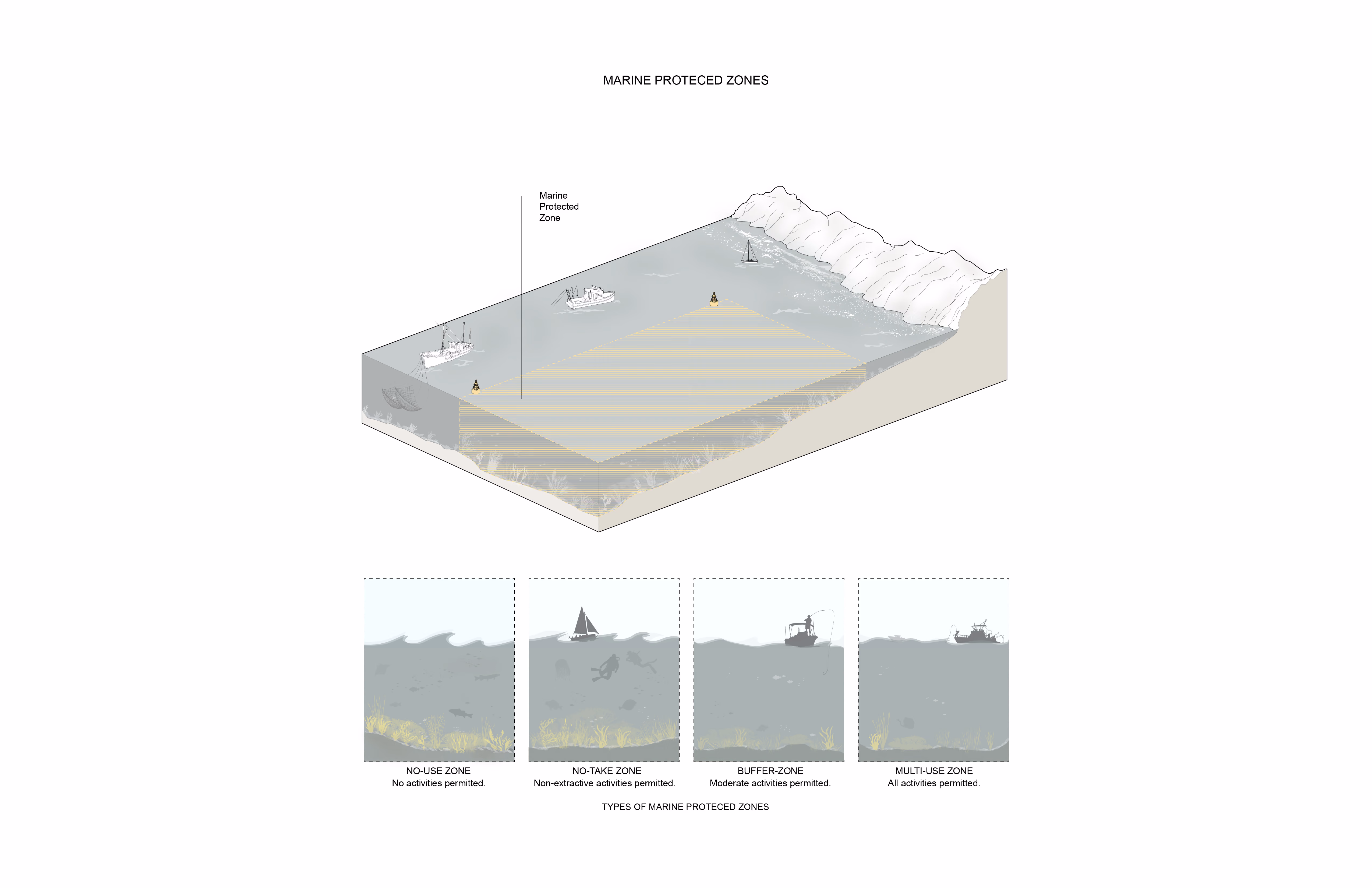
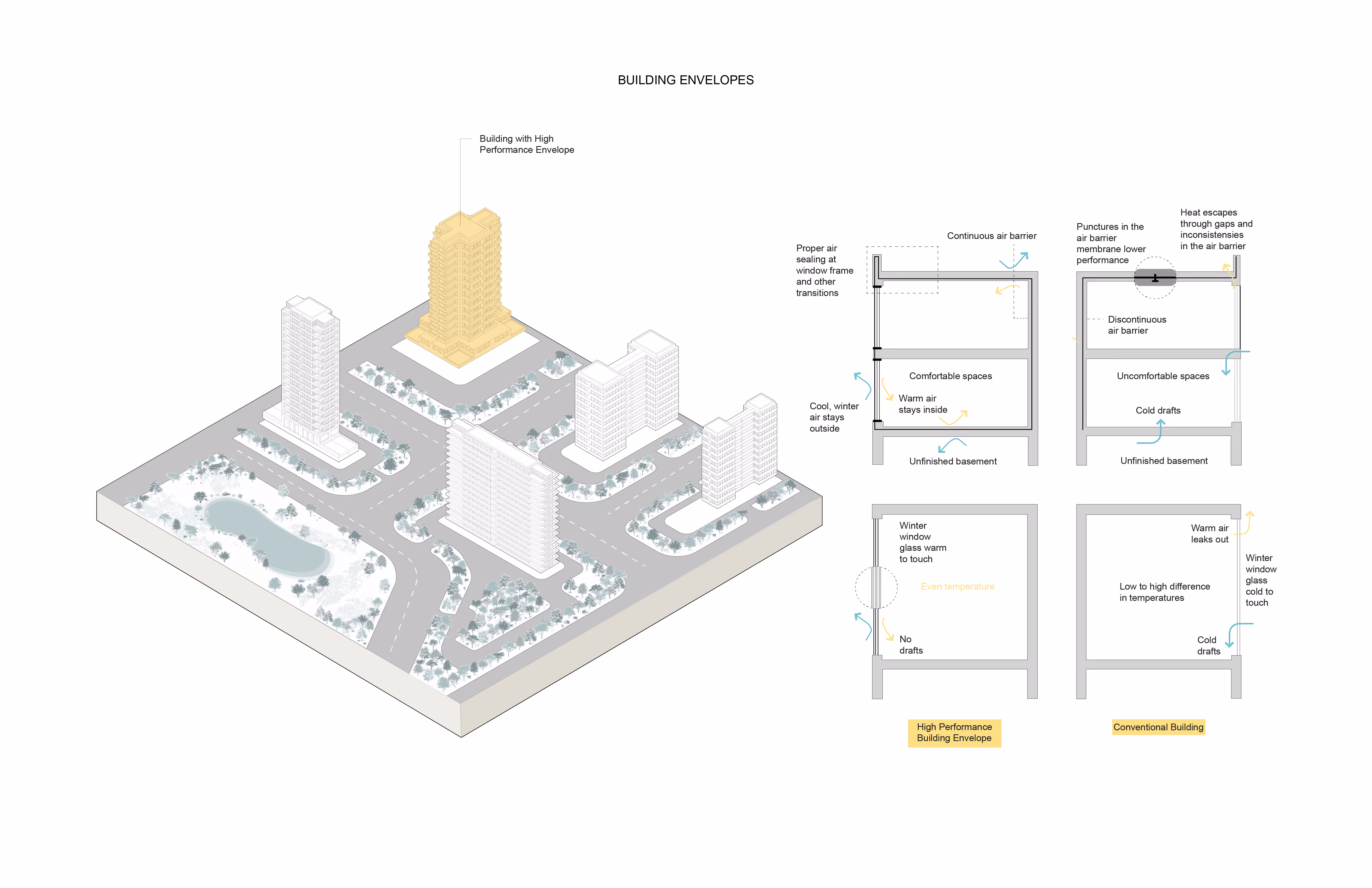
When evaporation exceeds precipitation, extreme water scarcity harms natural systems and livelihoods. Over forty percent of the world's land surface is arid or semi-arid, threatened by extremely low precipitation and climate-driven pressures that accelerate desertification. The Arid Section is a transect of a prototypical arid/semi-arid region, encompassing waterfront, urban, mid-rise, low-rise, and agricultural areas. The drawing represents climatic pressures such as extreme heat, fires, drought, and flash floods.
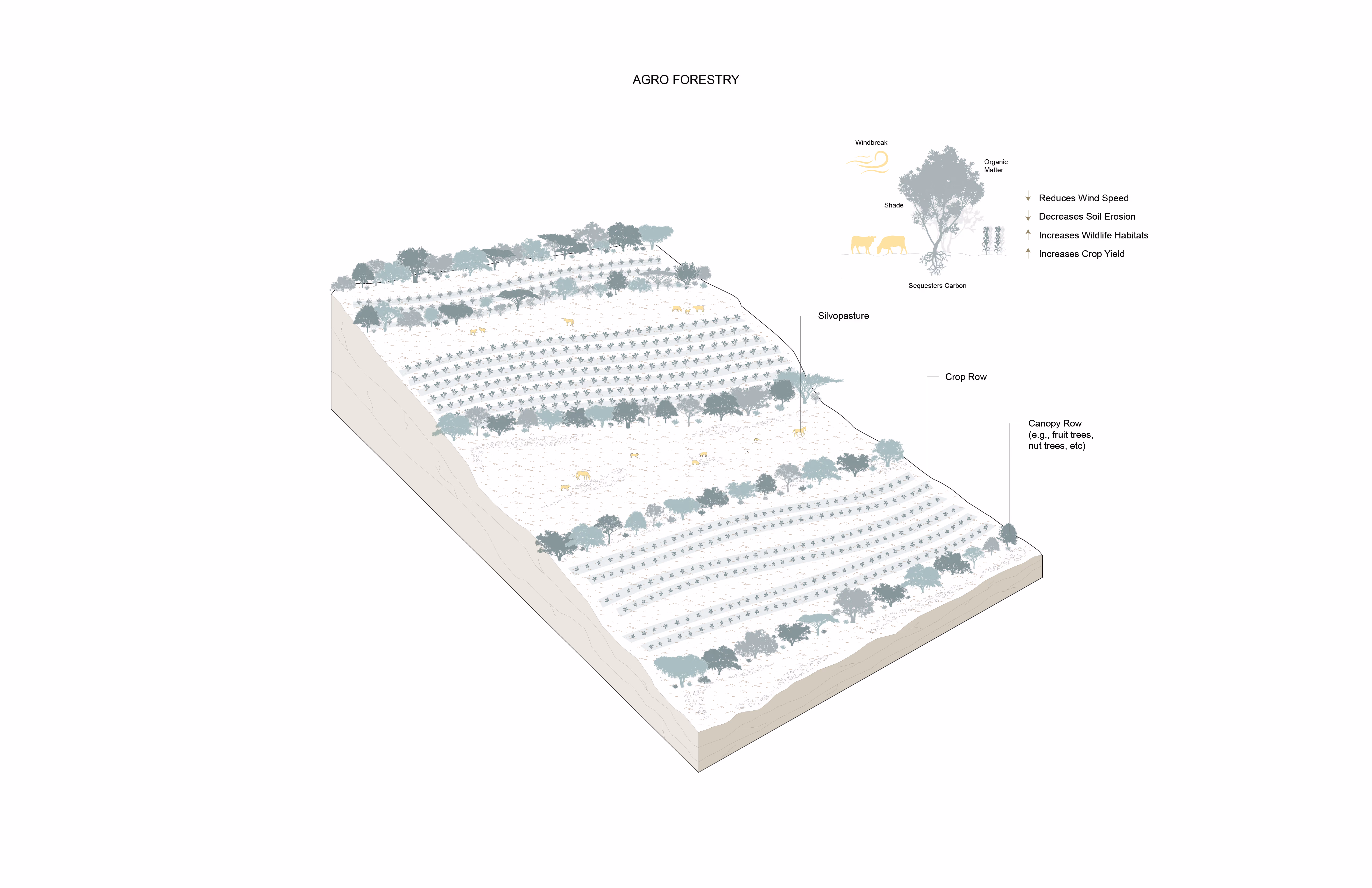
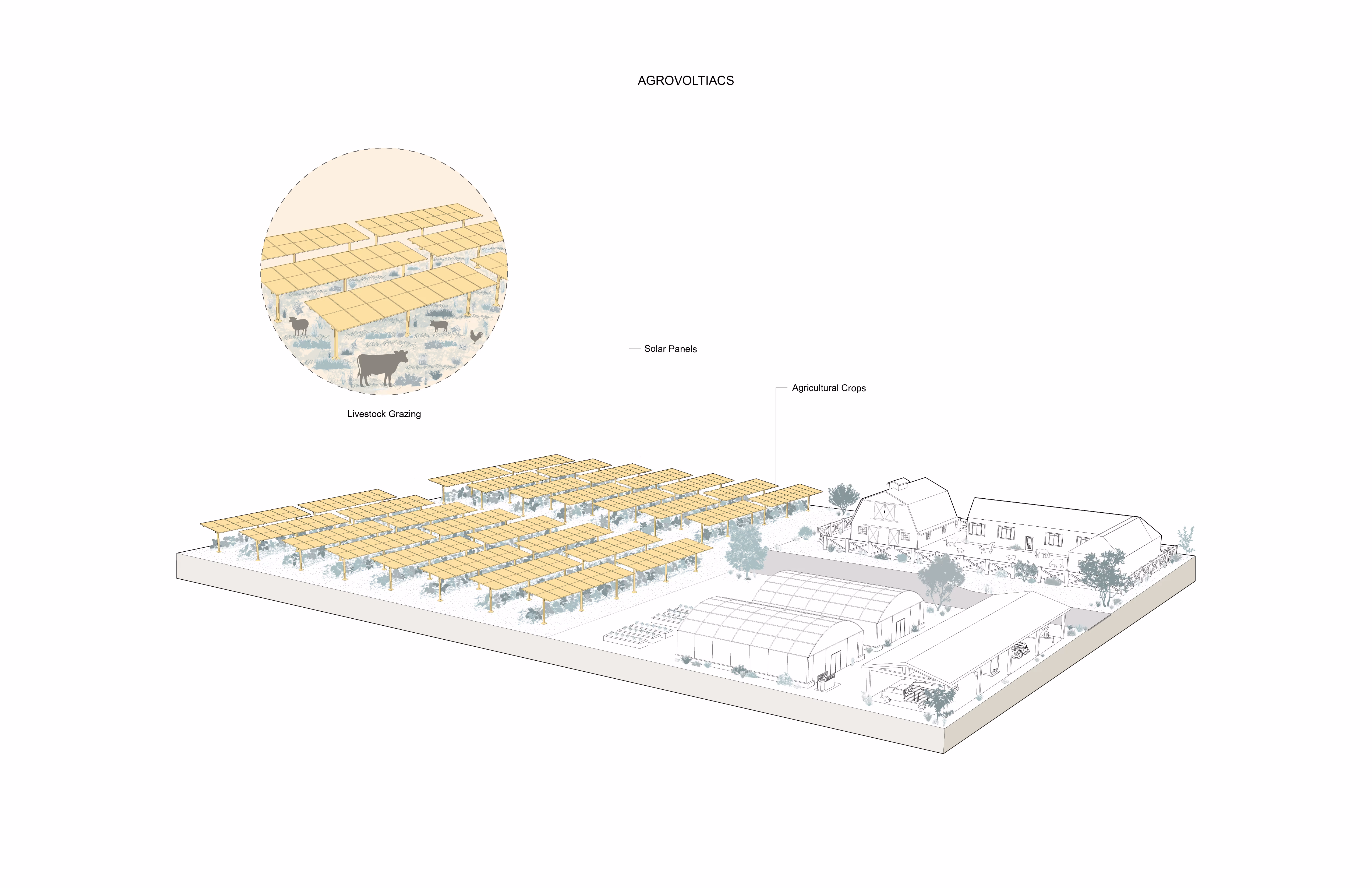
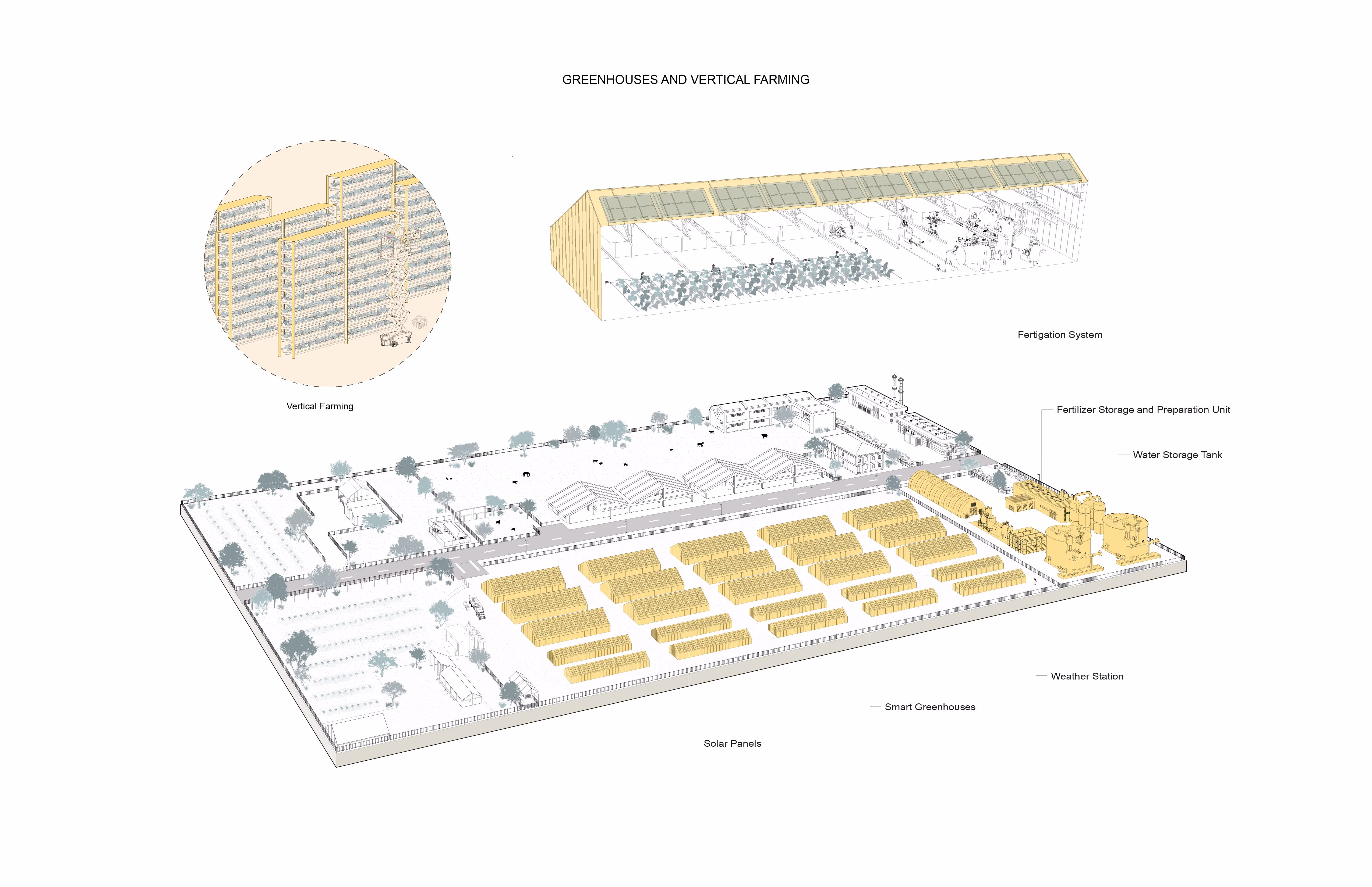
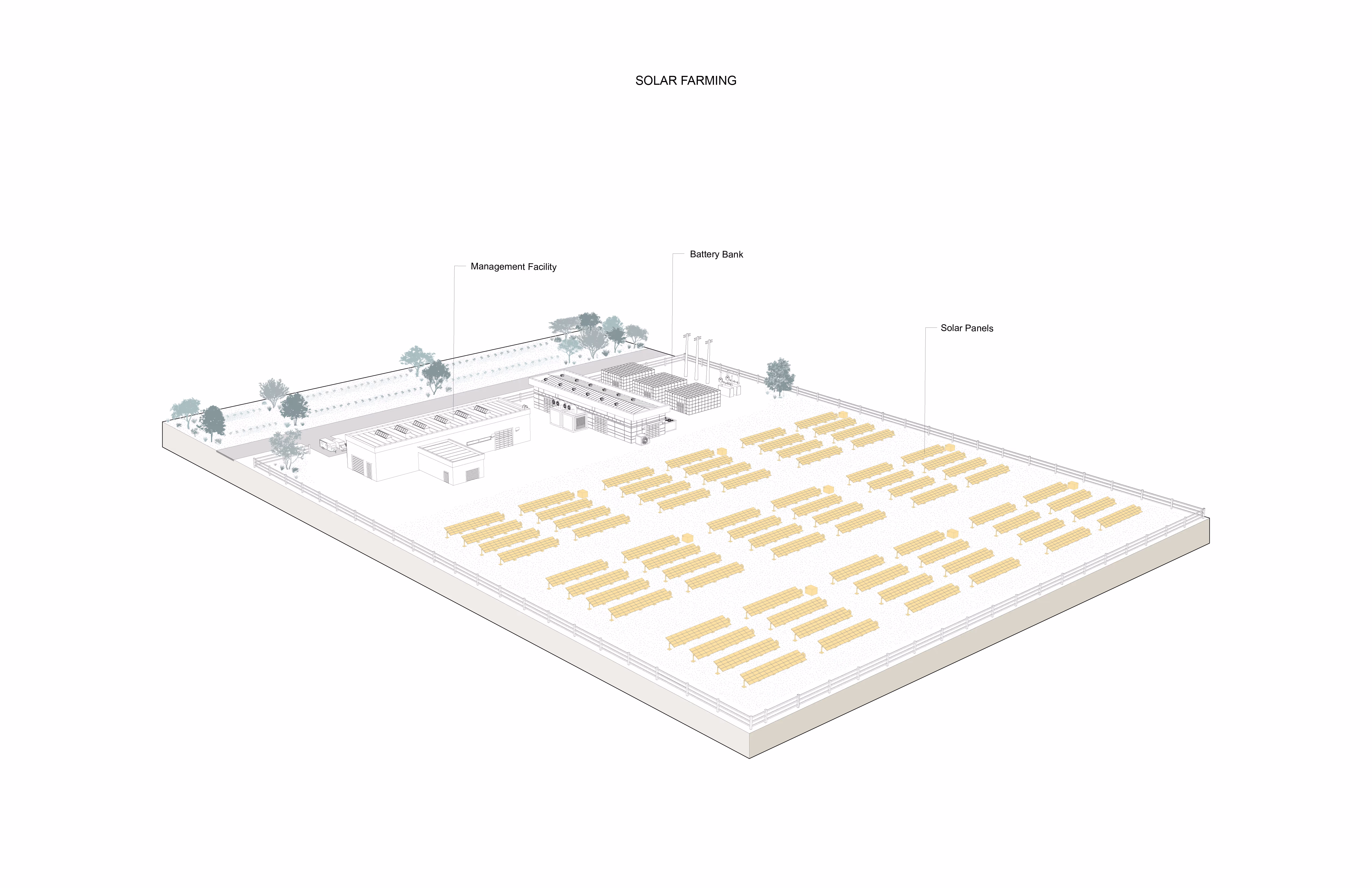
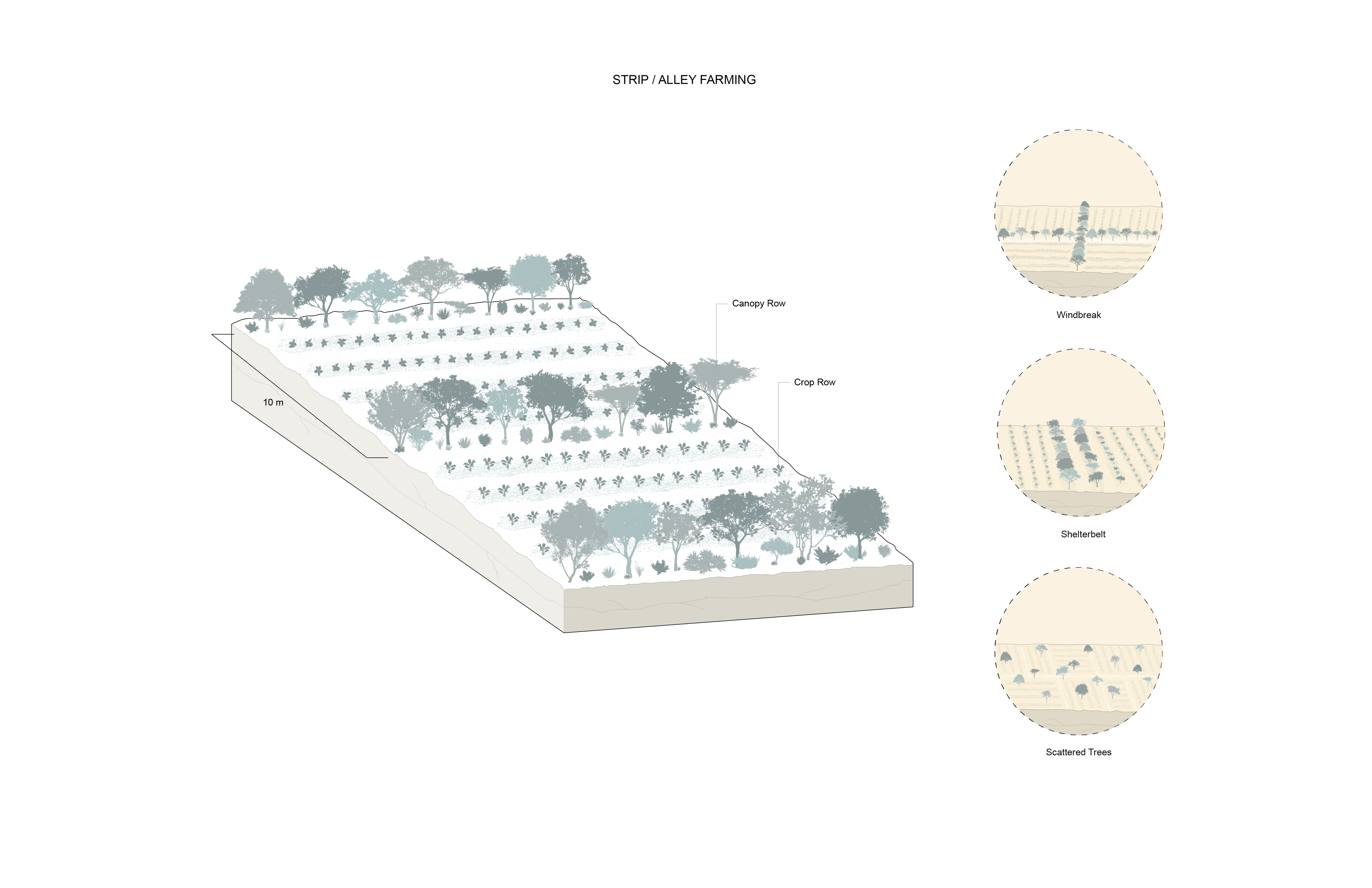
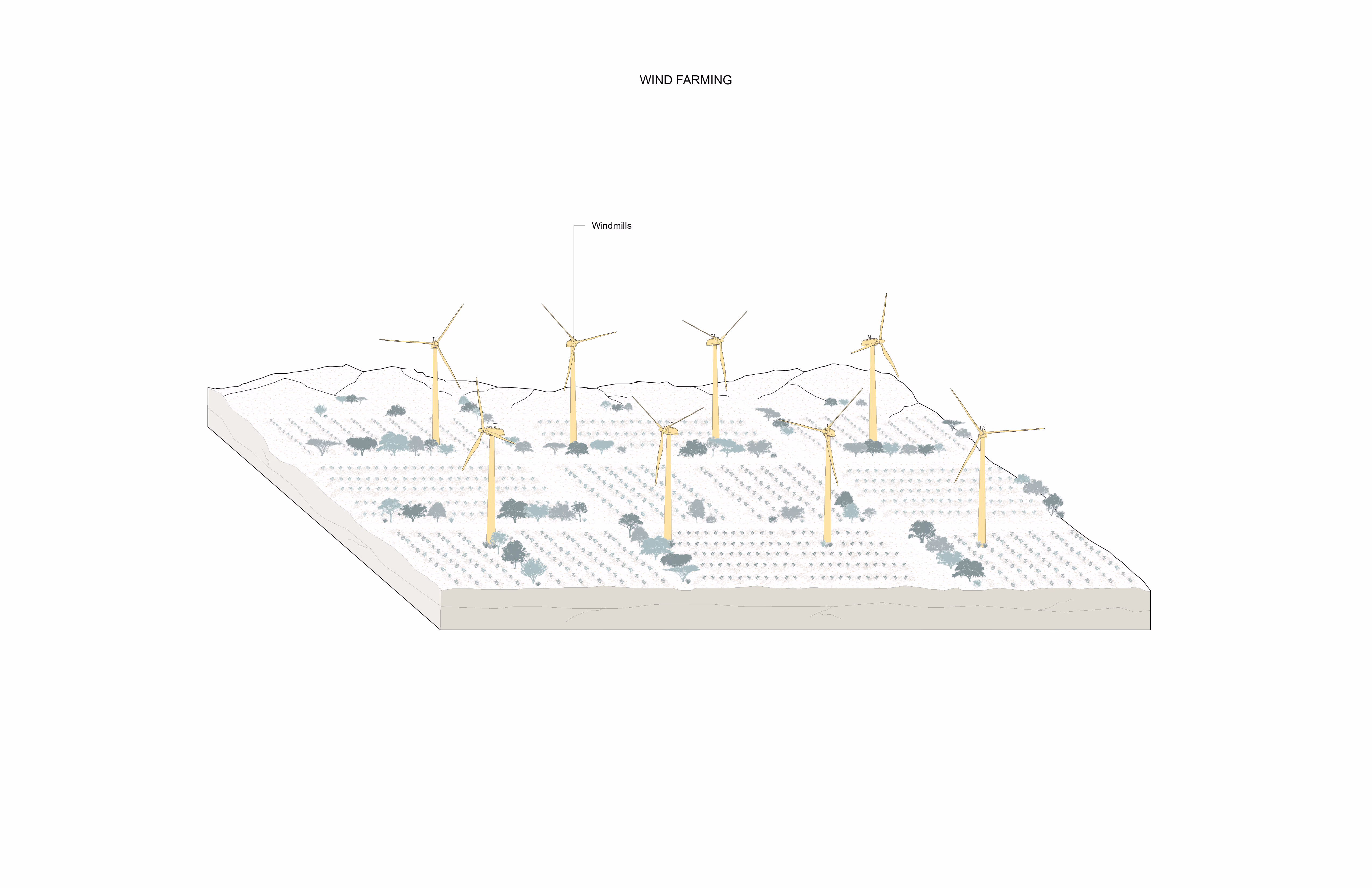
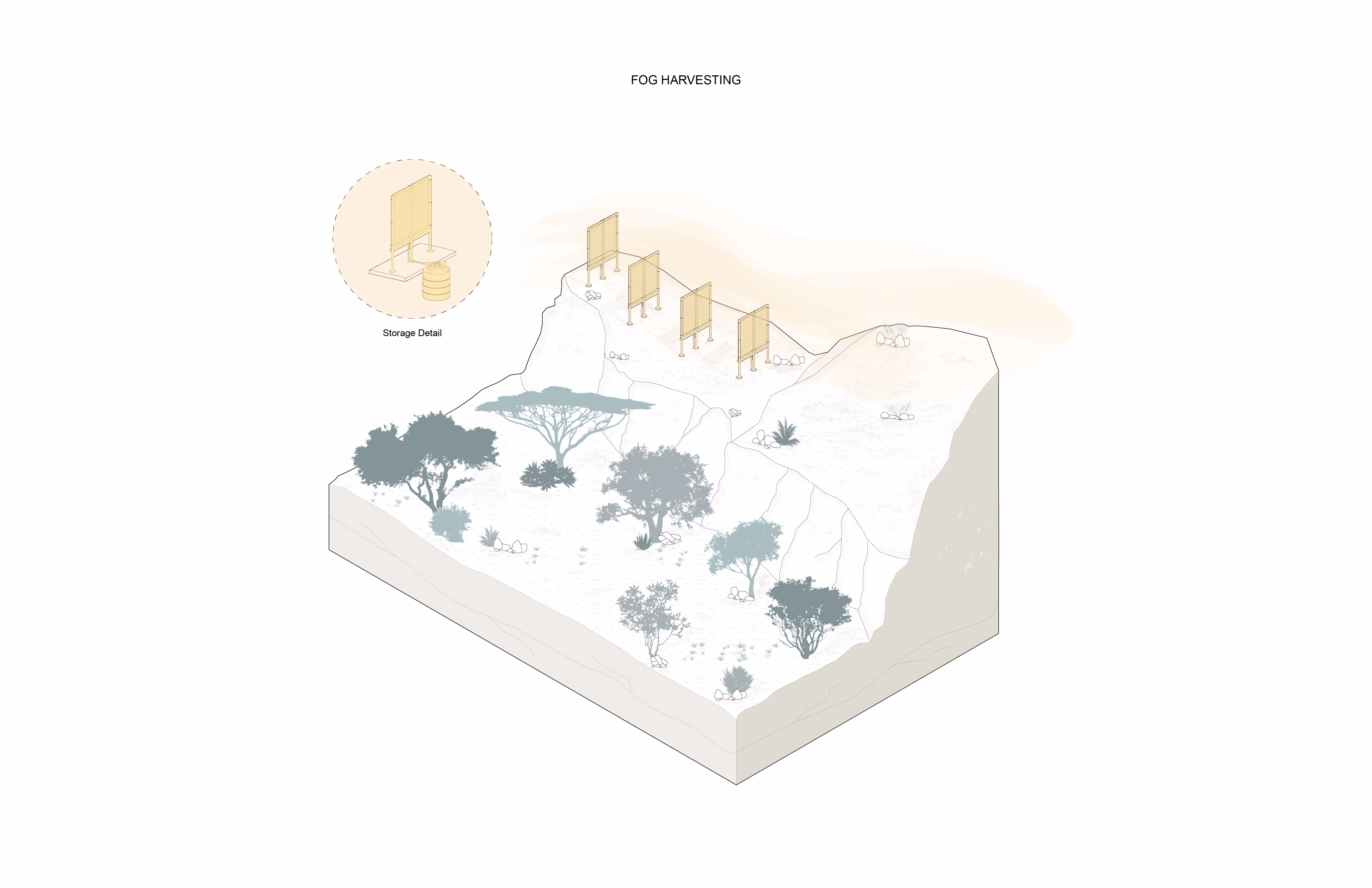
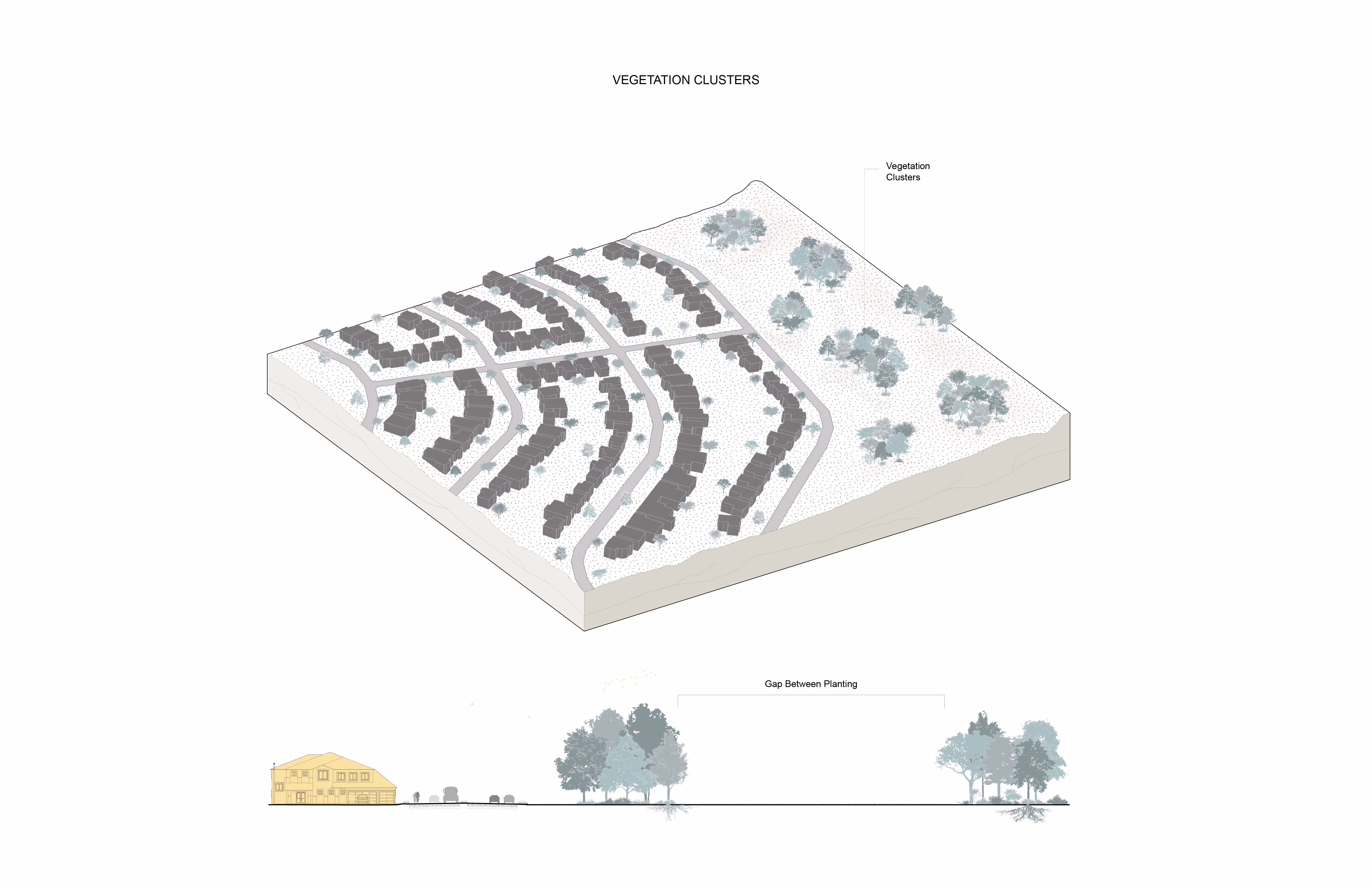
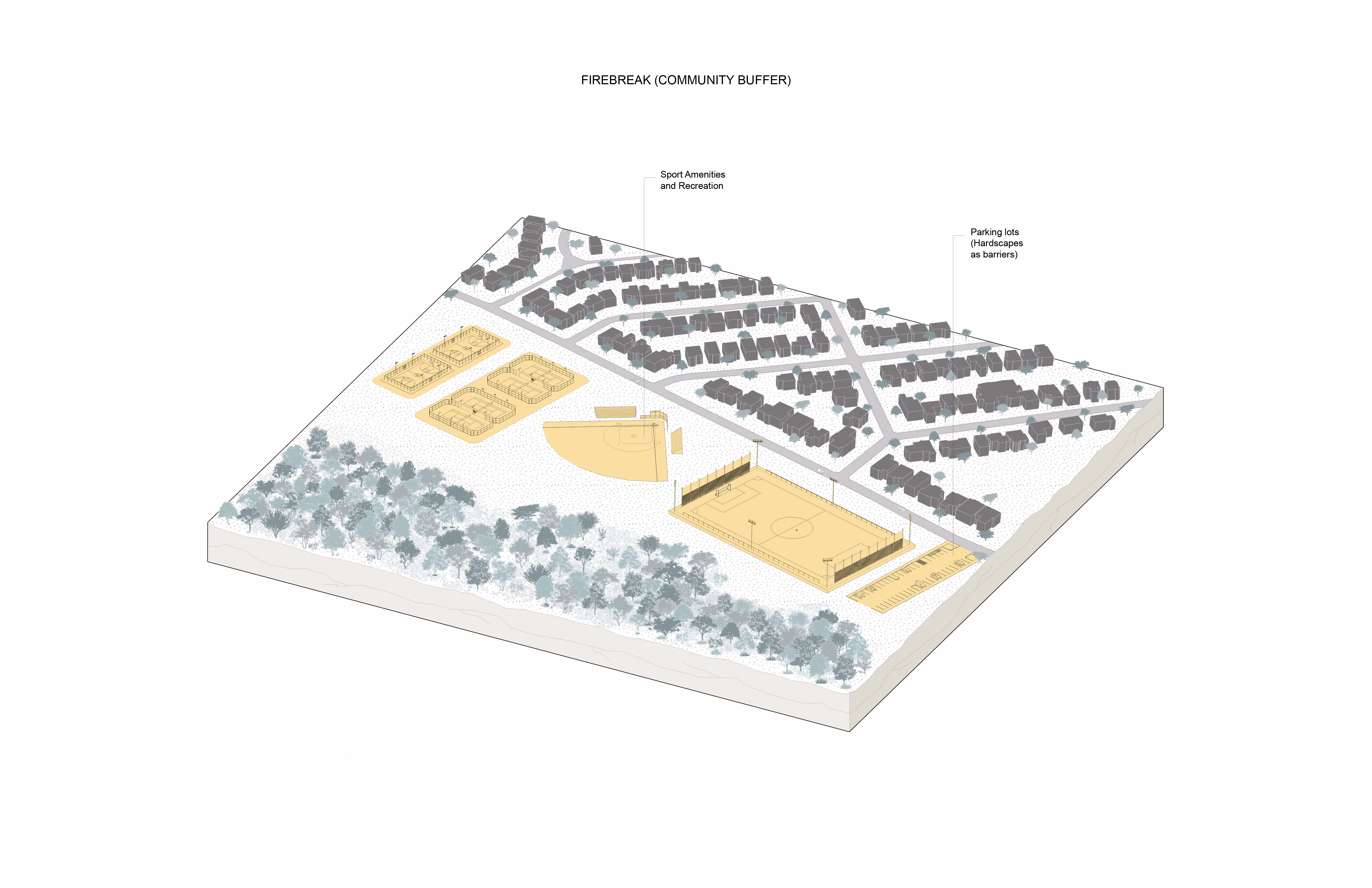
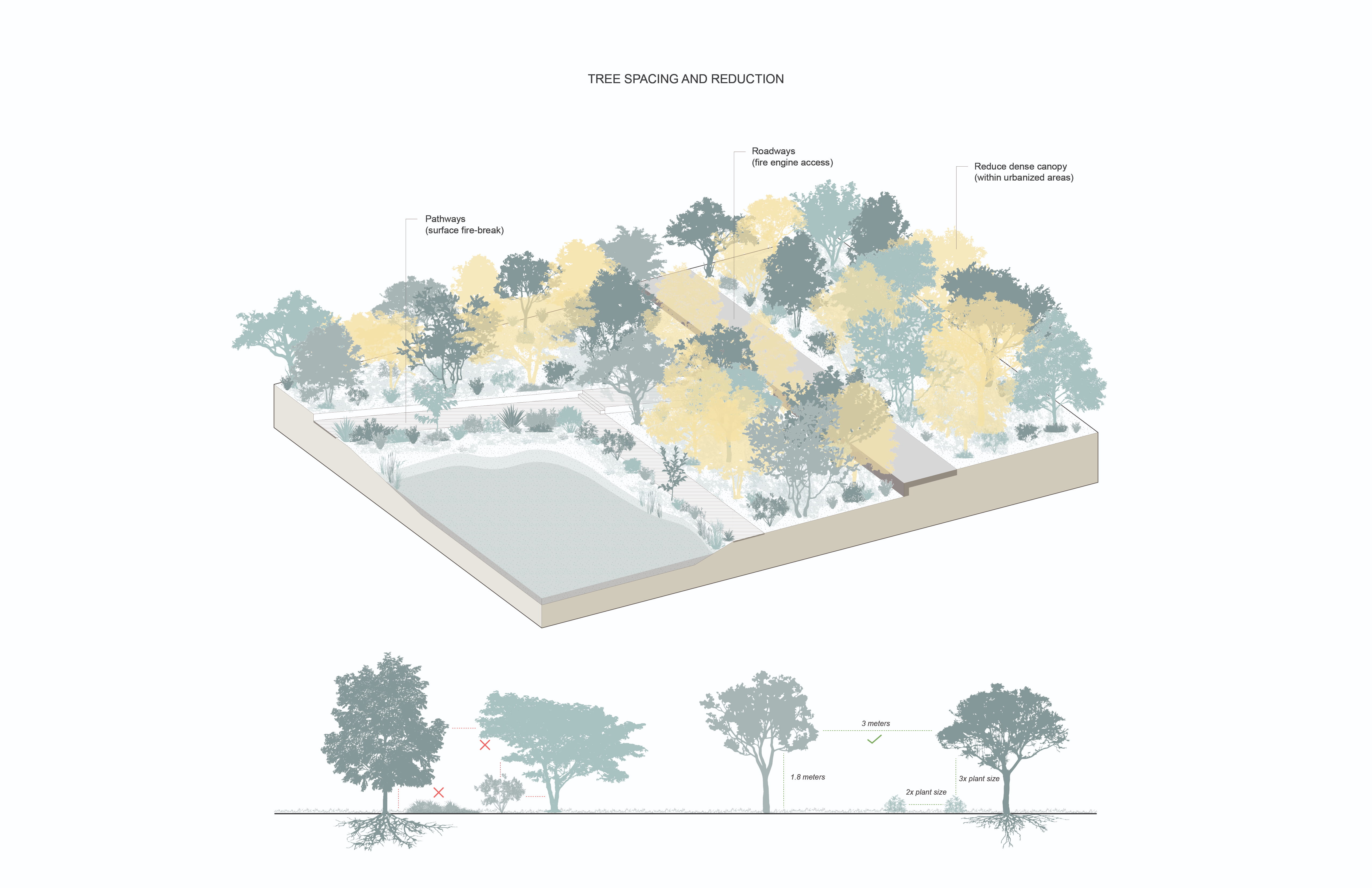
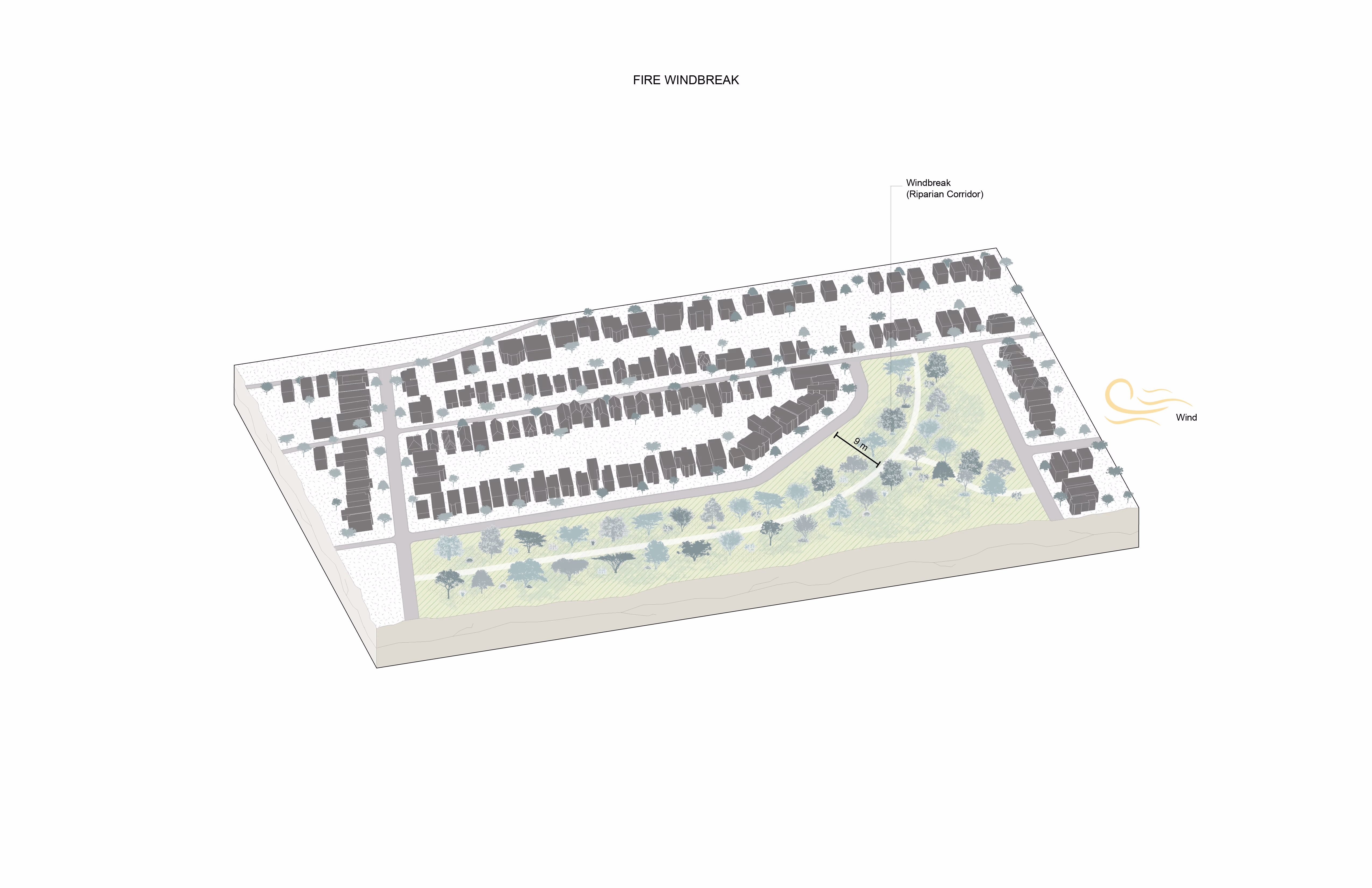
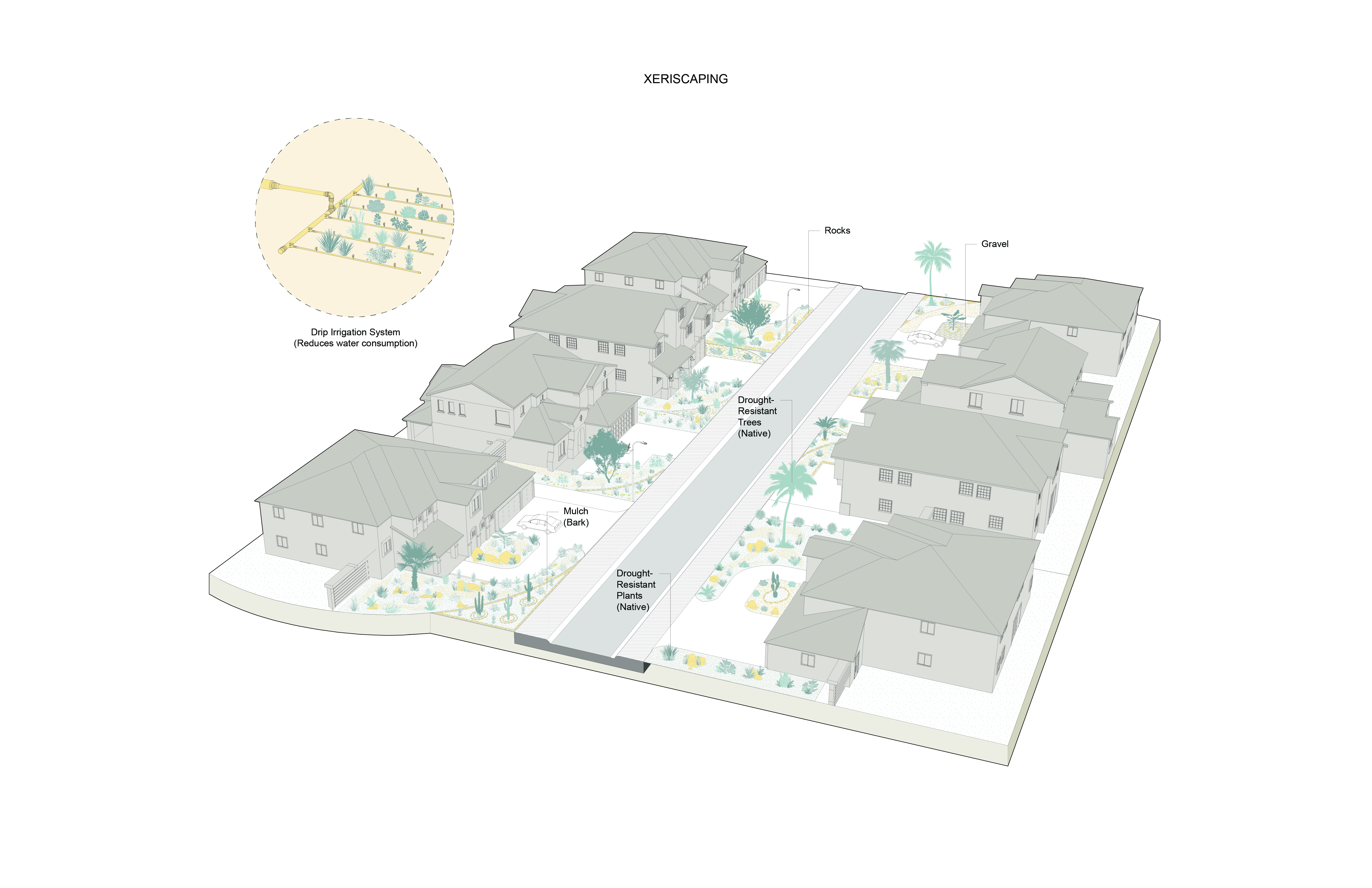
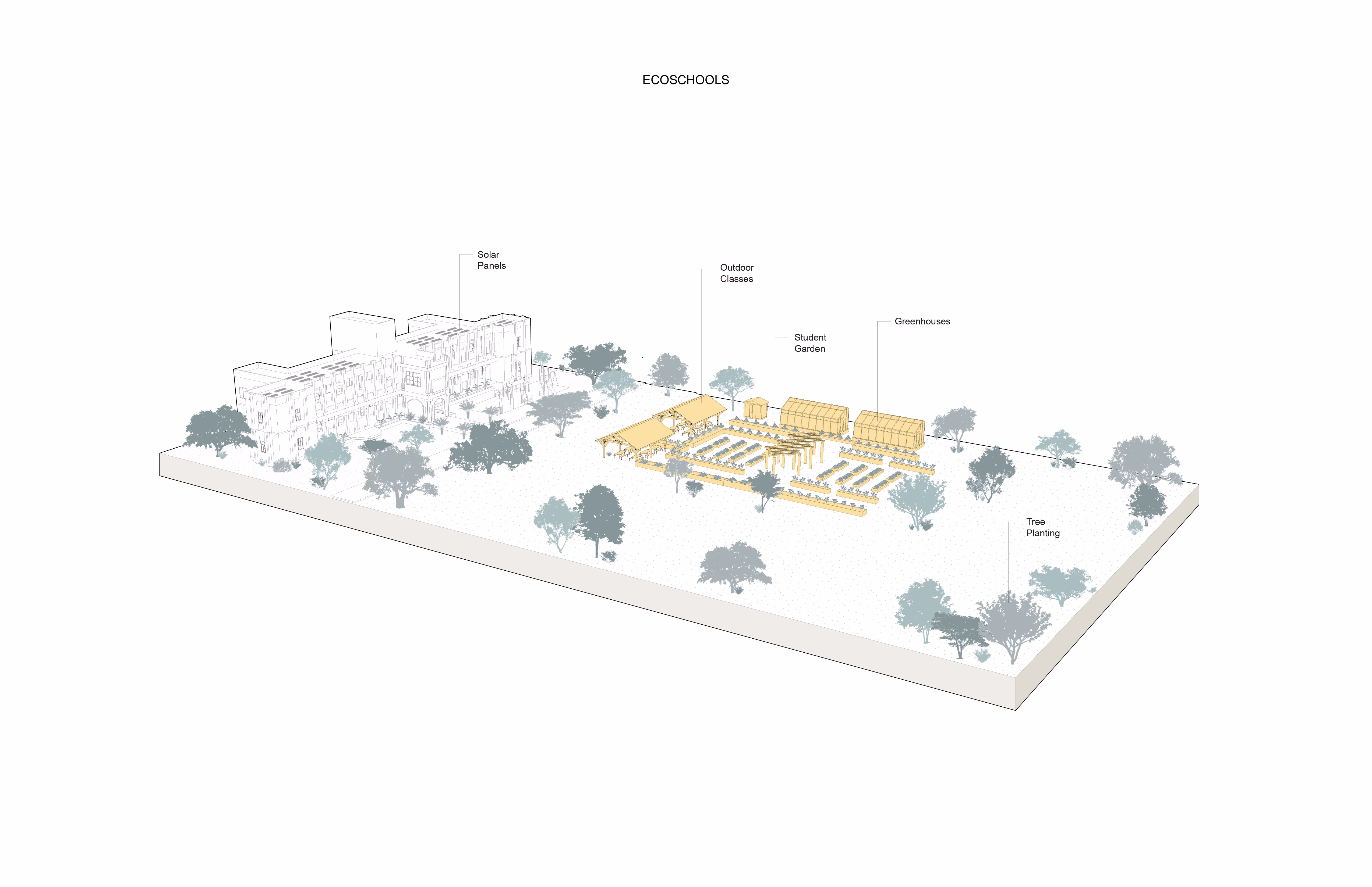
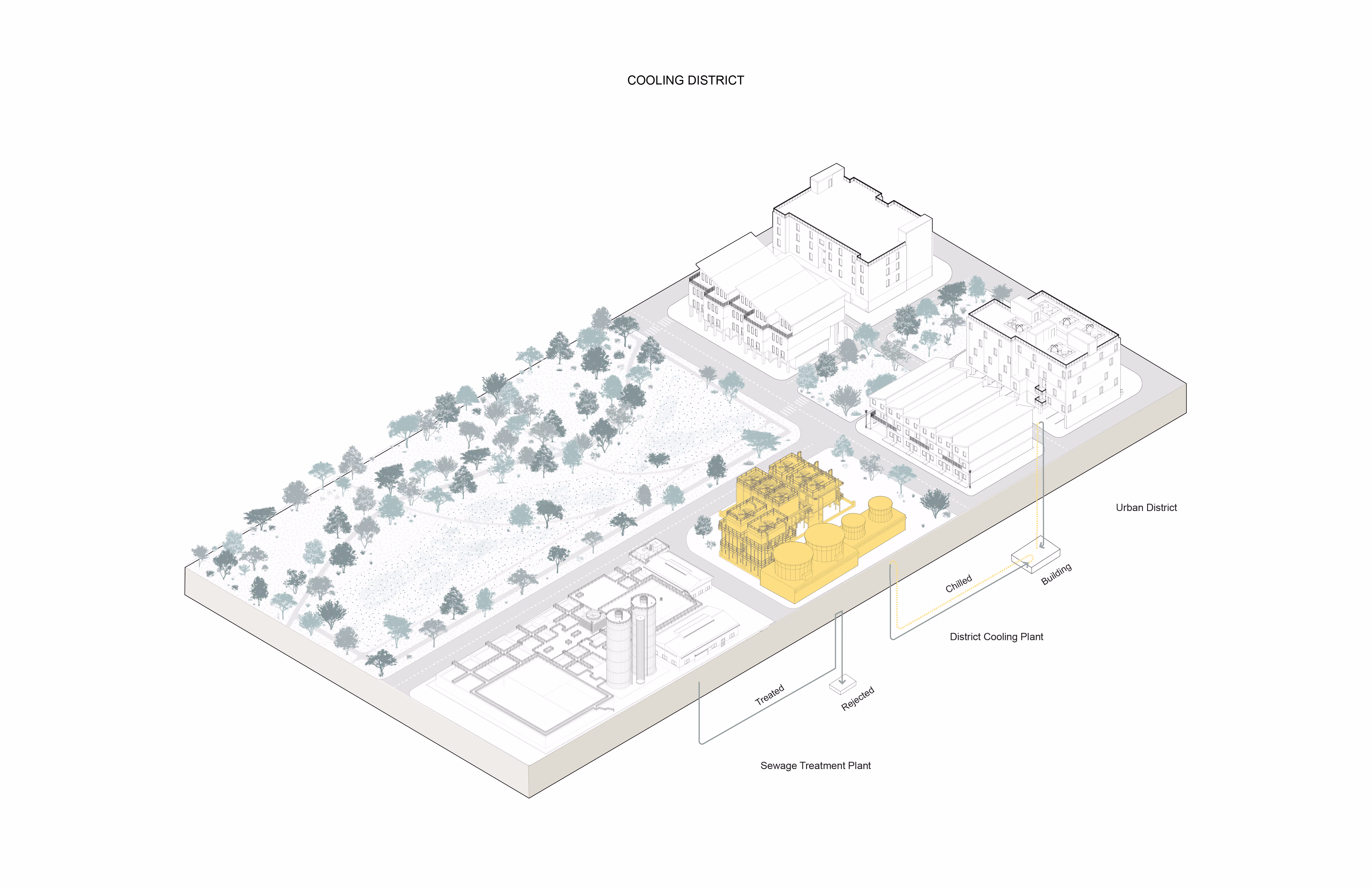
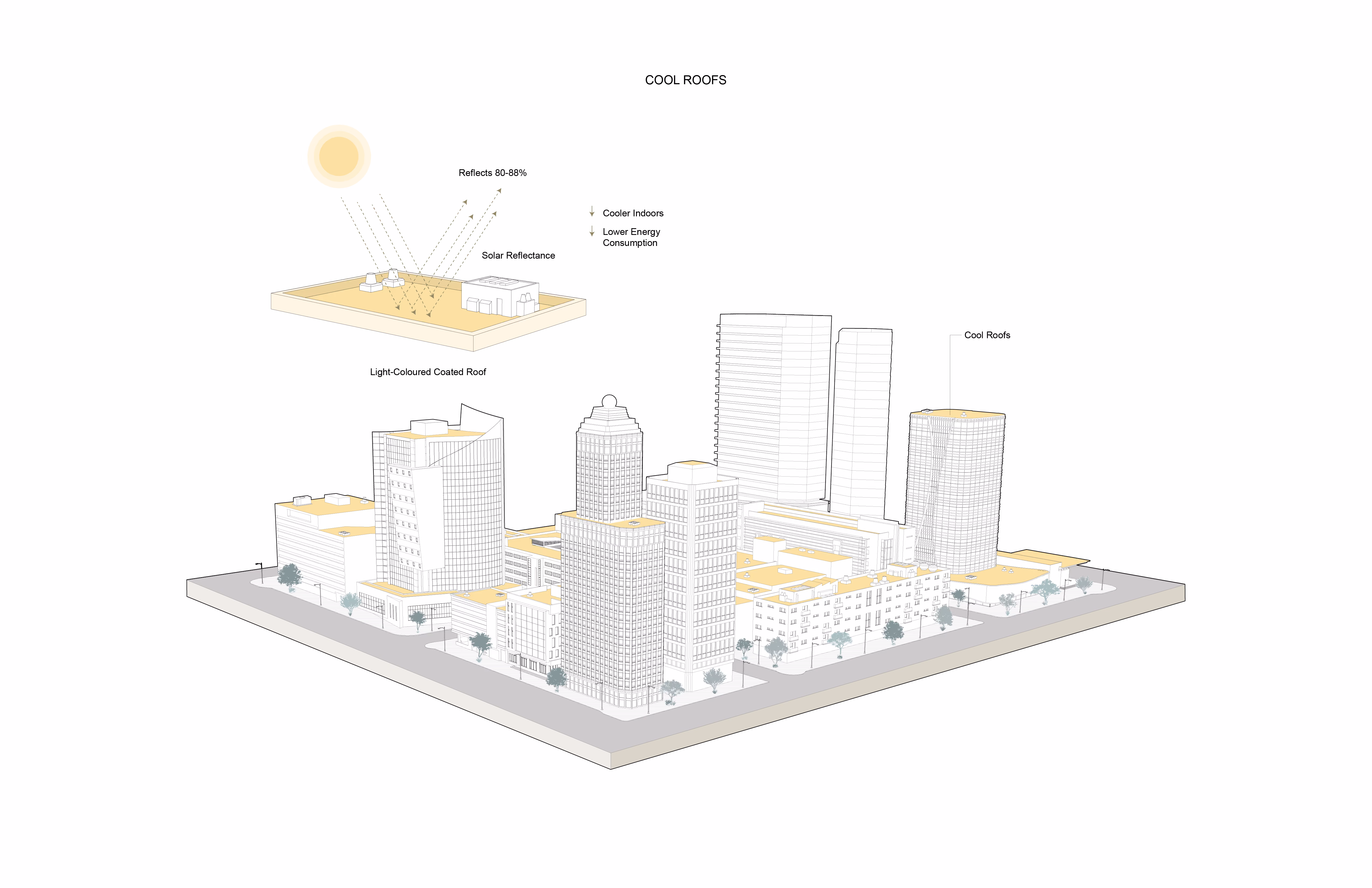
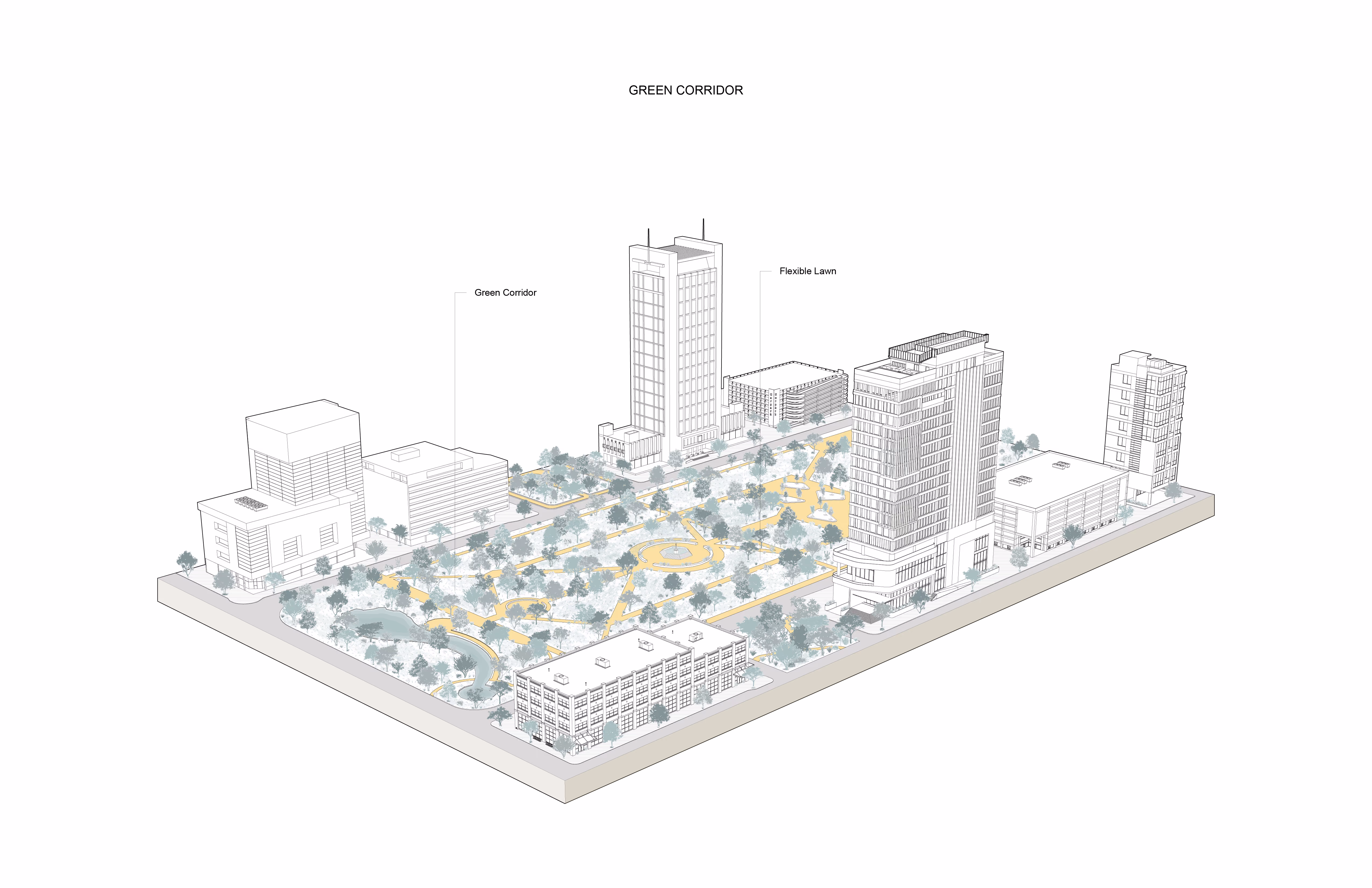
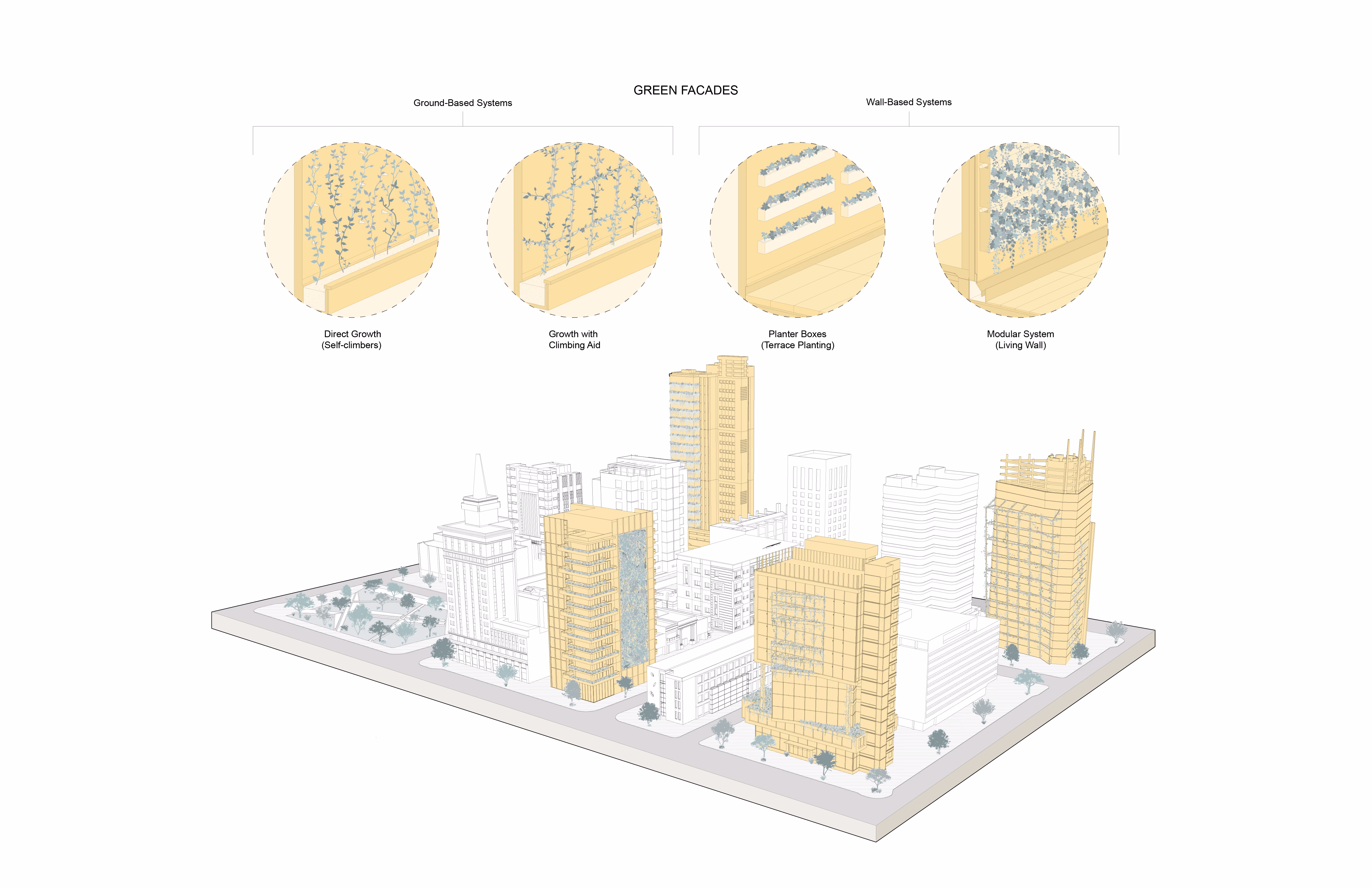
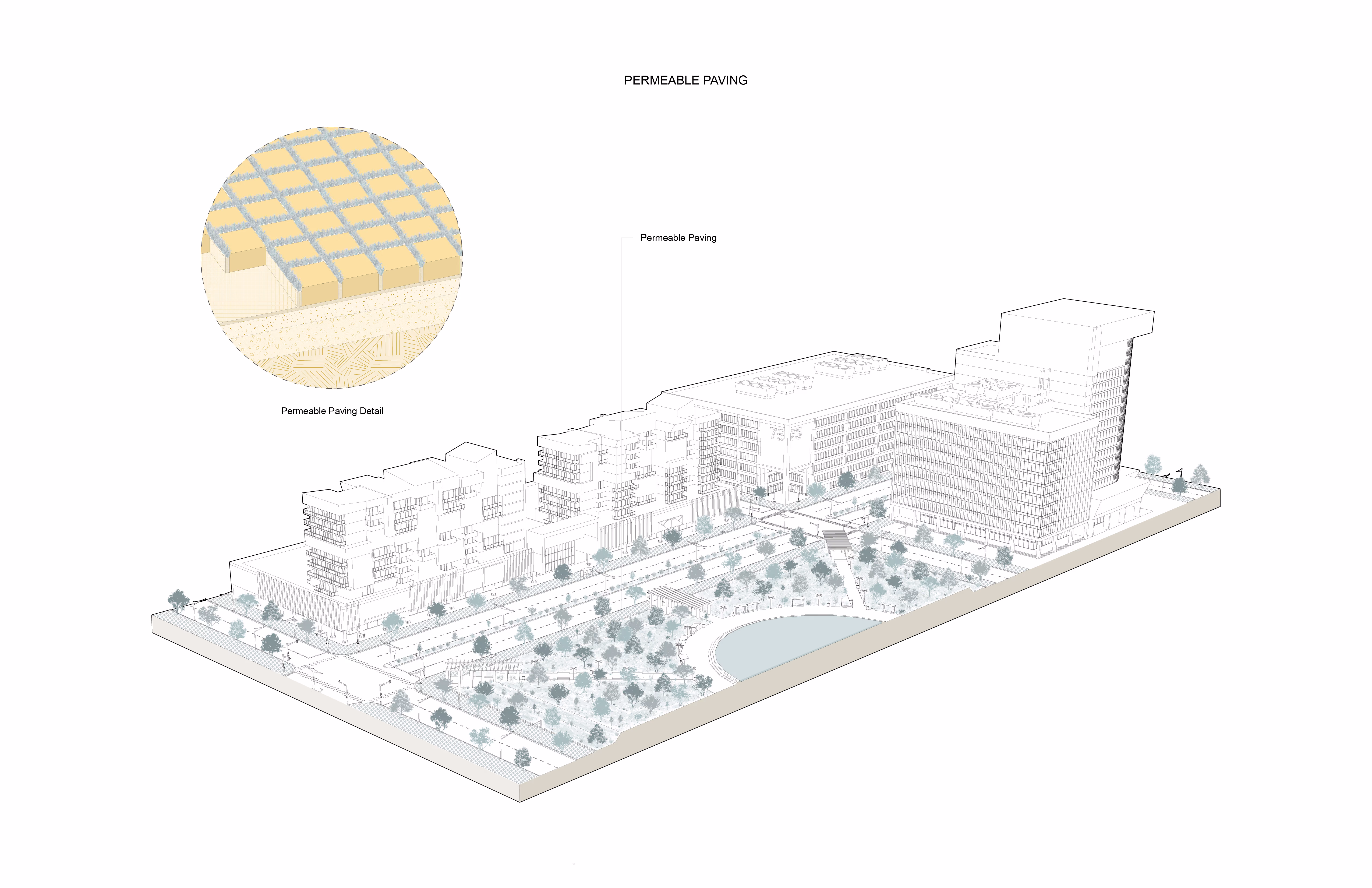
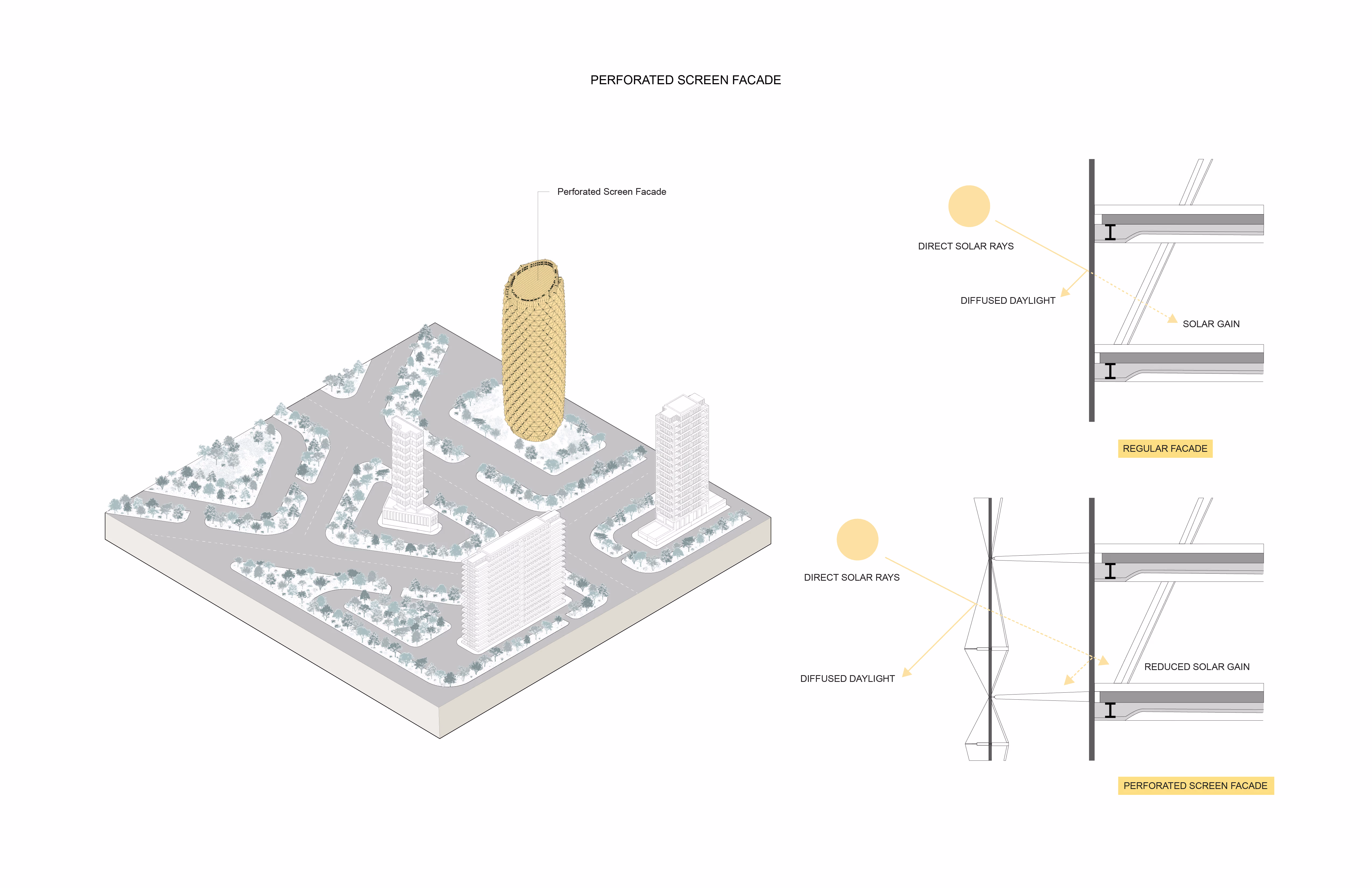
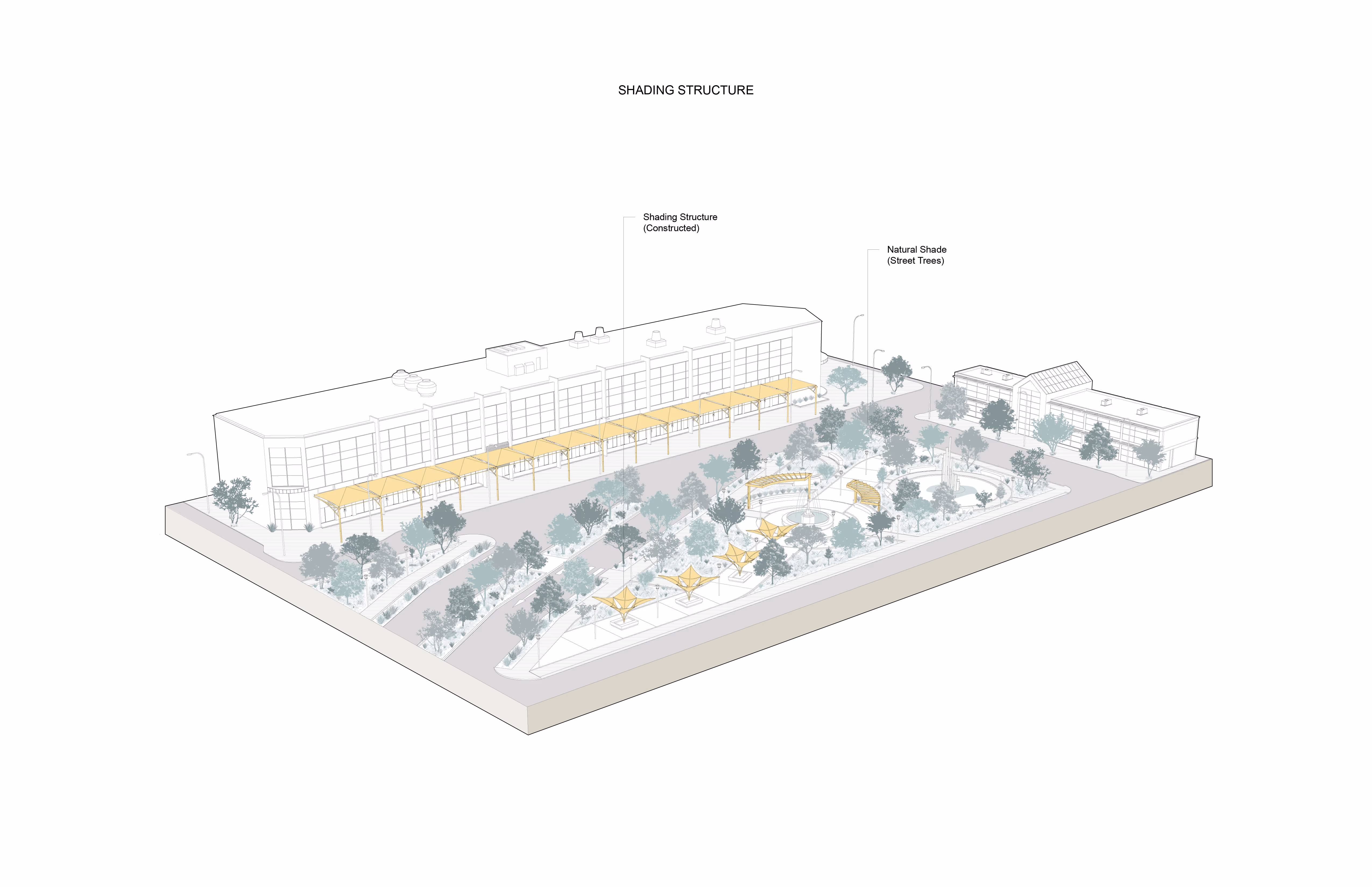
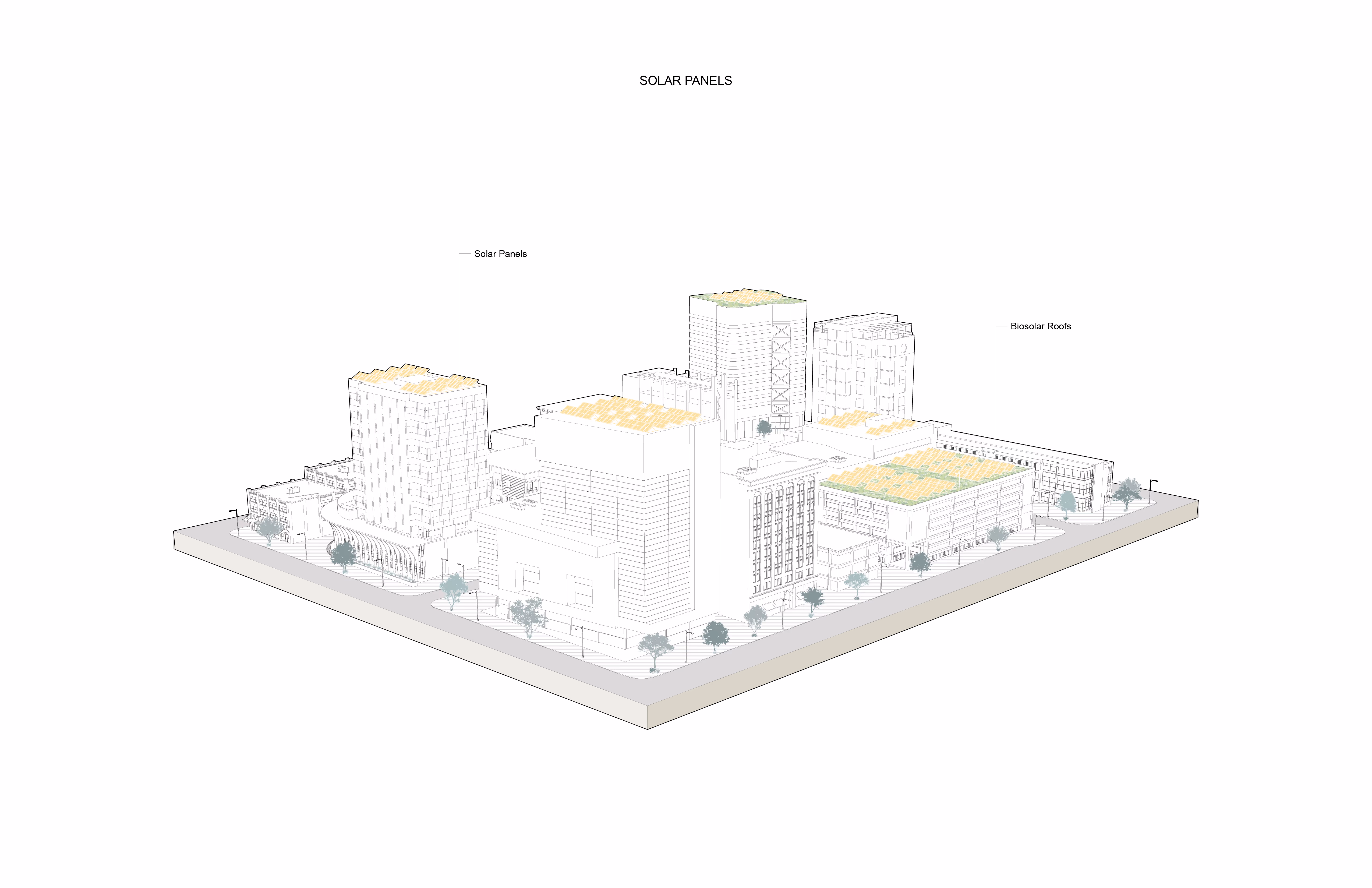
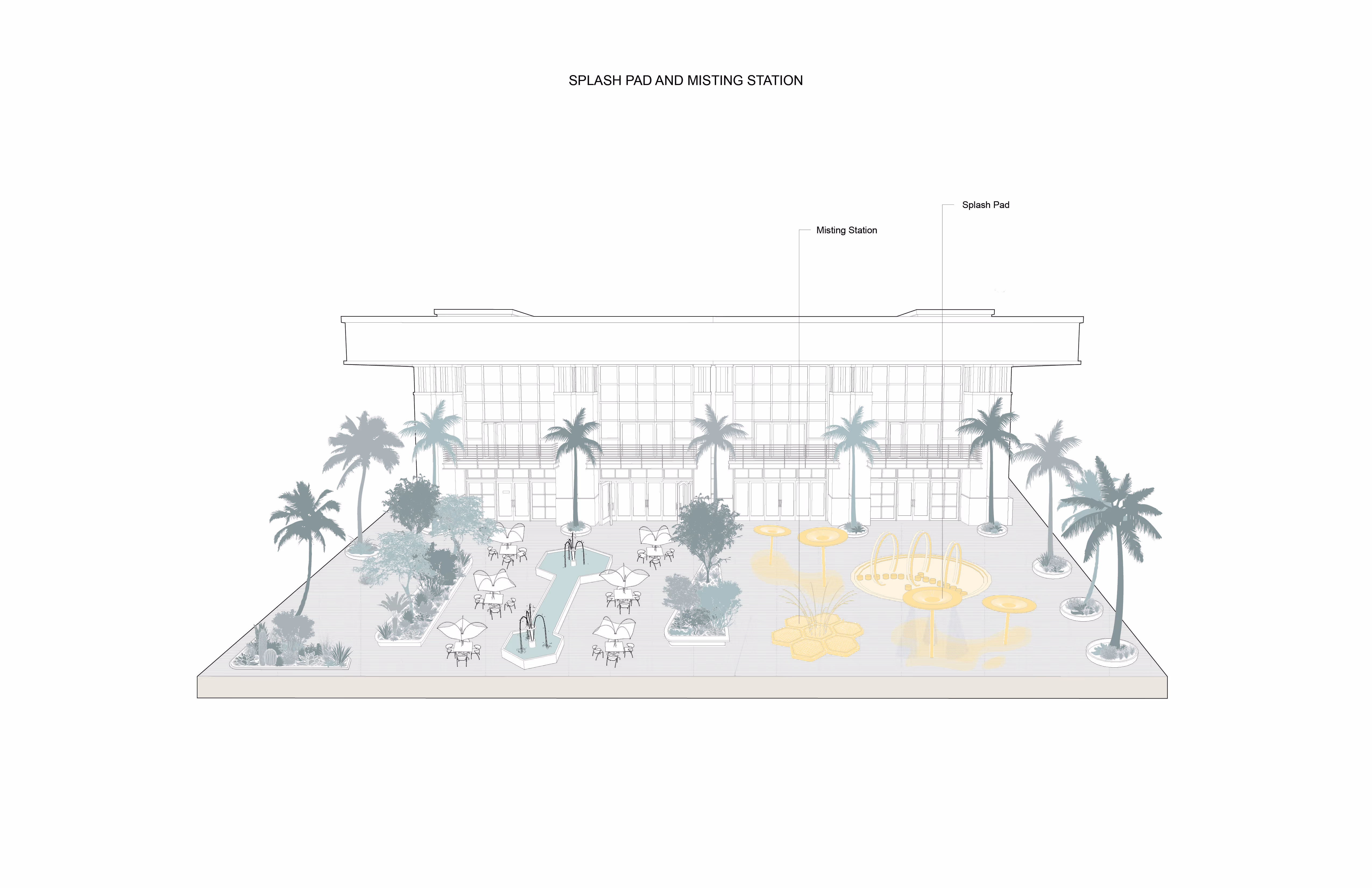
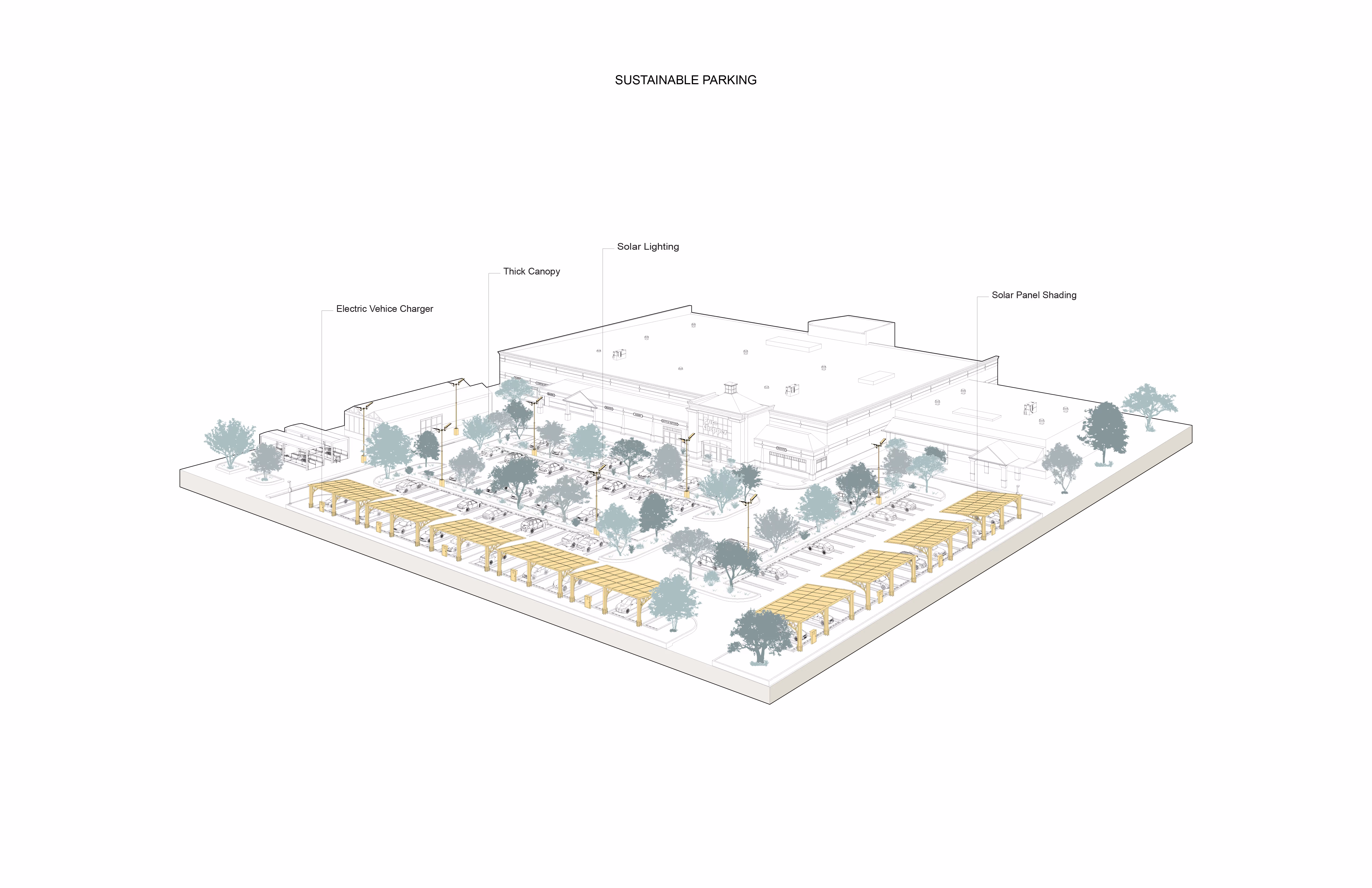
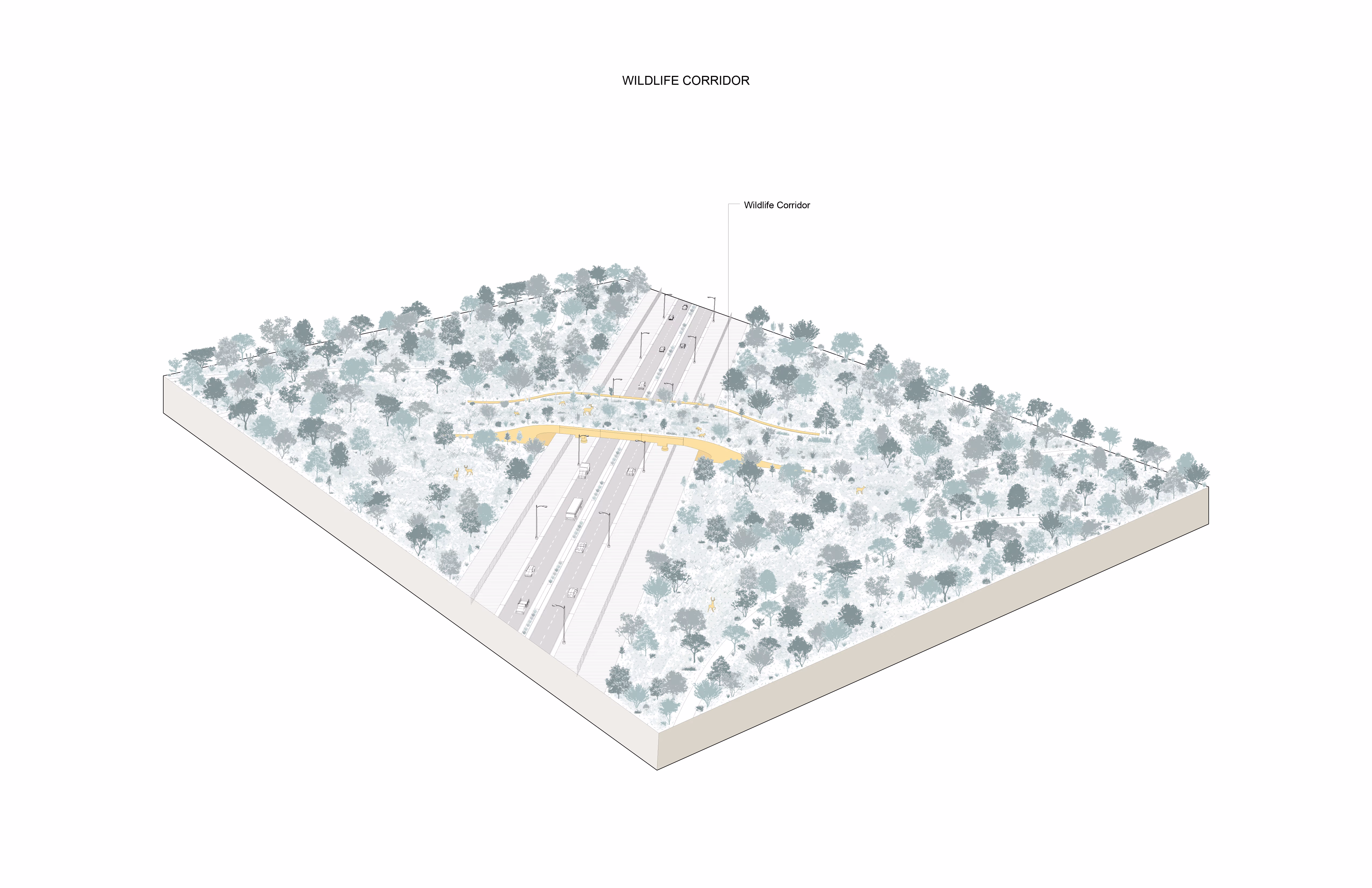
Ways to mitigate and adapt to these harsh conditions are represented by nearly one hundred climate resilience strategies visualized and indexed along the transect. The drawing spatializes natural, social, mechanical, agricultural, urban, and hydrological adaptation strategies at different scales, from site-scale to new models of urbanism and land-use planning.
This drawing is meant to be shared in various public spaces and forums to offer and highlight the opportunities and potential of resilient and adaptive design.
TeamFadi Masoud (PI), Orly Sacke, Kwan Woo Lee, Jack Mok, Mikaela Magtanong, Aynur Omar, Marie-Ellen Houde-Hostland, Mena Hameed, Vineel Sharma, Rahat Mirza