
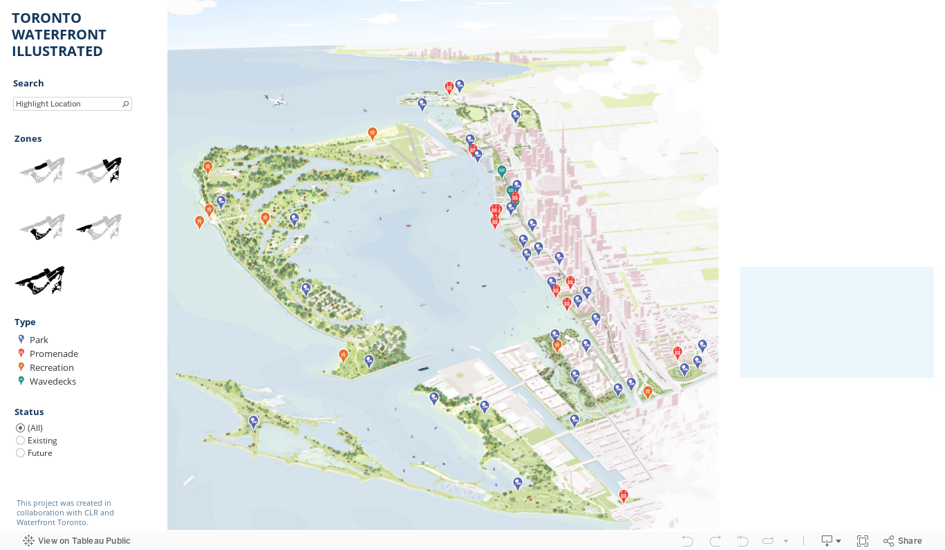
The CLR is currently developing a detailed and interactive 'big picture' rendering of the Toronto Waterfront in collaboration with Waterfront TO. The illustration captures the vibrance, energy and vitality of the Toronto harbour, stretching from Ashbridge's Bay to the Humber River watershed. The resulting iterations of this project will emphasize Toronto's unique relationship to water while multiple zoomed-in views highlight the breadth of public developments Waterfront TO has facilitated now and into the future. With the addition of interactive and temporal components, the project showcases the stories and intimate moments that define the identity of the Toronto shoreline while visualizing Waterfront TO's proposed "green necklace" extending from the inner harbour to downtown core.


Team
Fadi Masoud, Nadia Chan, Tina Cui, Stefan Herda, Ambika Pharma